Where AiroMap makes the difference
In sectors where accuracy is essential, AiroMap delivers fast and reliable insight. See how the system is applied.
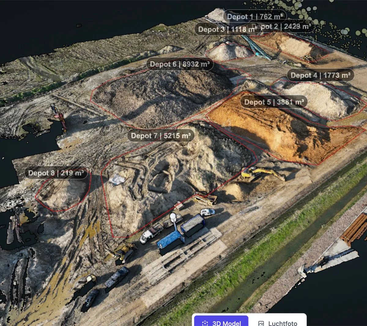
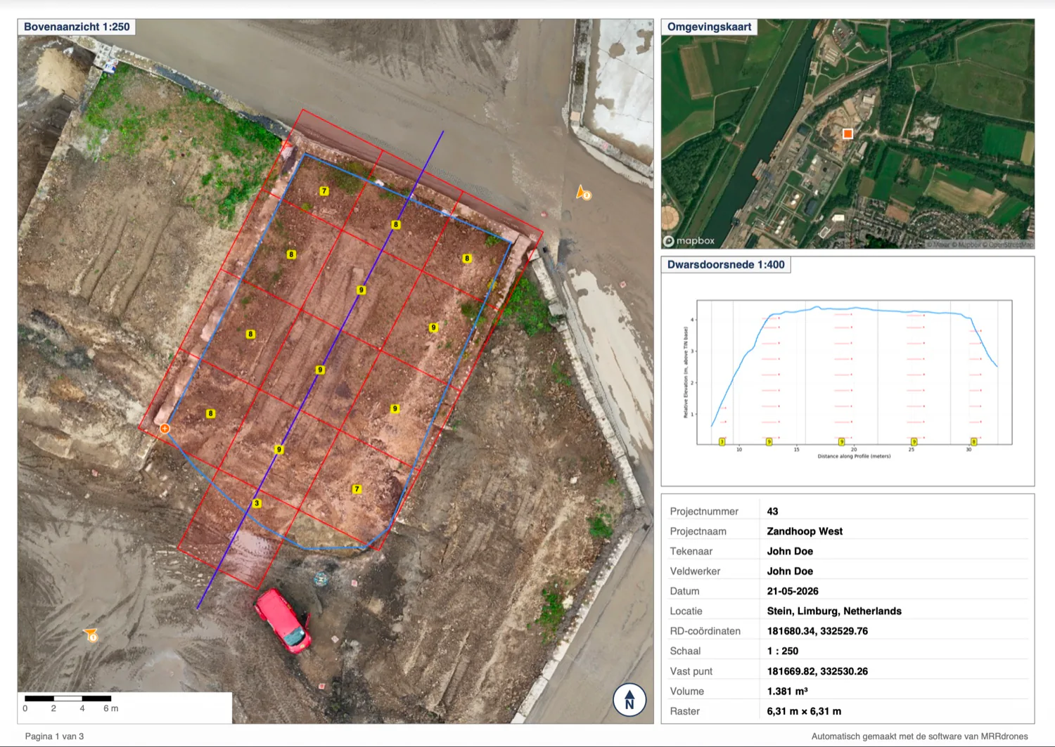
Stock & volume measurements
Measure exact volumes of stockpiles and bulk flows within minutes. No more manual estimates and no debate about quantities.
Read more
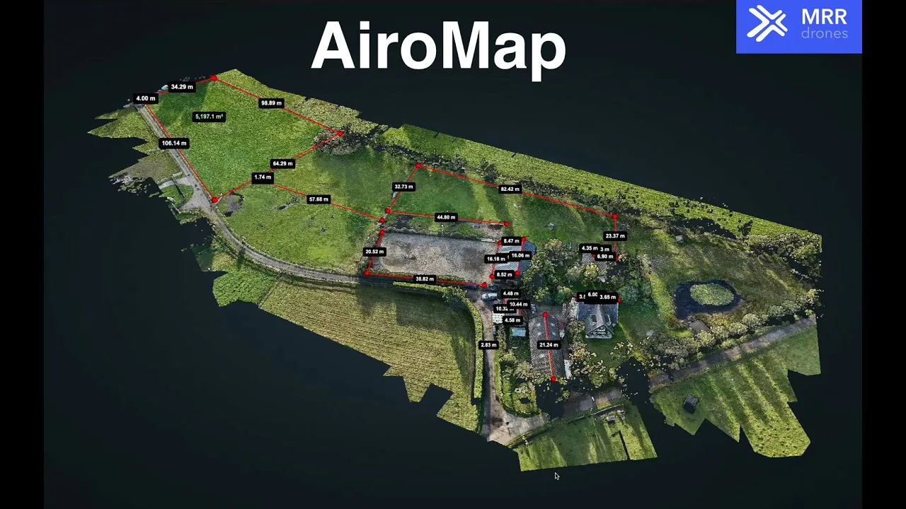
Civil engineering & infra
Always up-to-date 3D models for planning and progress. Measure heights, calculate cut/fill balances and overlay the design onto reality.
Read more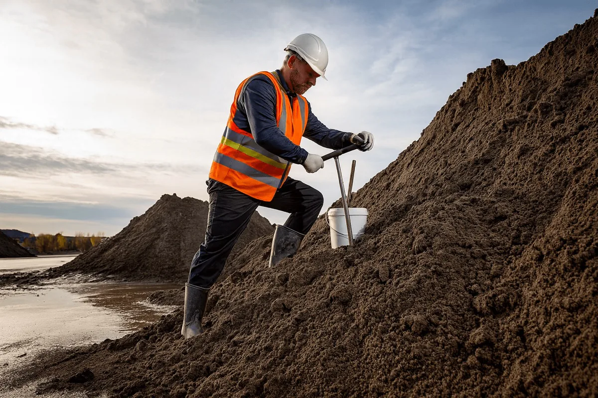
AP04 batch inspections
Automatic measurements following the AP04 guideline. Fully documented and ready to use for sampling and reporting.
Read more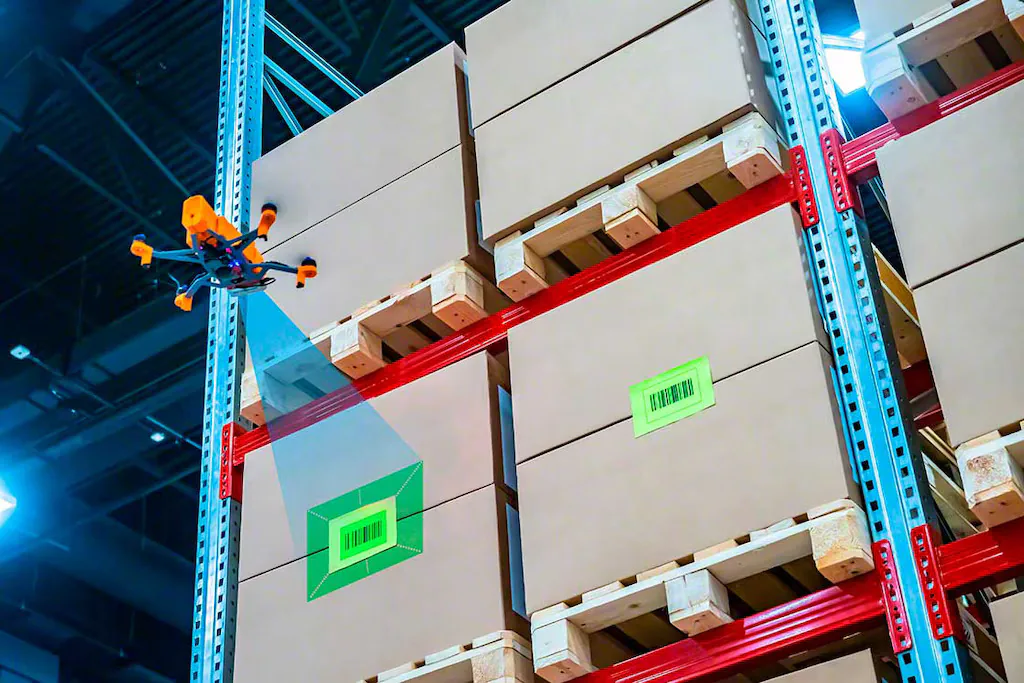
New applications
A different measurement need in mind? Through new apps AiroMap expands to extra use cases — think roof inspections. We think and build along with you.
Read moreWithout hard numbers it stays guesswork
Important decisions call for facts. But capturing reality accurately is difficult, time-consuming and expensive.
Disputes over the numbers
Without a clear measurement, doubt arises about quantities, yields and accountability.
Dependent on third parties
You rely on an external agency. That comes at a cost, and they aren't always available when you need them.
Inconsistent way of working
Every measurement is done a little differently — depending on the person, method or moment. That makes results hard to compare and quality varies.
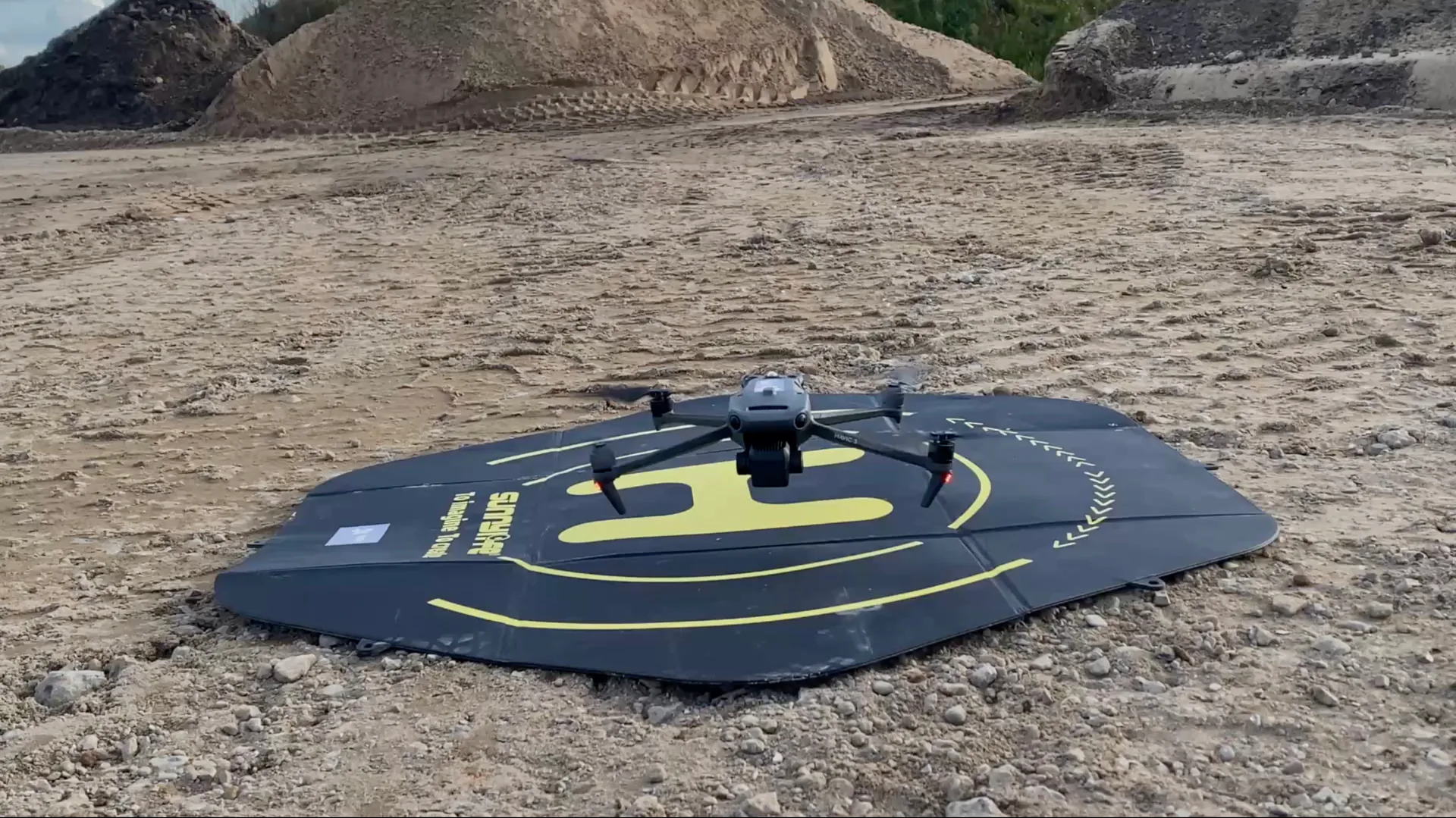
That's why we built AiroMap: a drone that flies entirely on its own and captures reality for you from start to finish.
One platform. Automatic results.
The drone flies entirely by itself, the software calculates automatically and your report is ready online.
Fully taken care of from start to finish
You don't have to figure anything out yourself. We think of everything and set it all up for you, so you can get started simply, automatically and without any prior knowledge.
Drone + software
A drone tuned to the system and the AiroMap platform work together seamlessly.
Training + support
Training at your own location and support from real people afterwards, with a phone number you can simply call.
Licence + insurance
We arrange the complete package, so you don't have to worry about a thing.
Clear measurement reports
Measurements and reports, ready to use directly as PDF, Excel, DXF or LandXML.
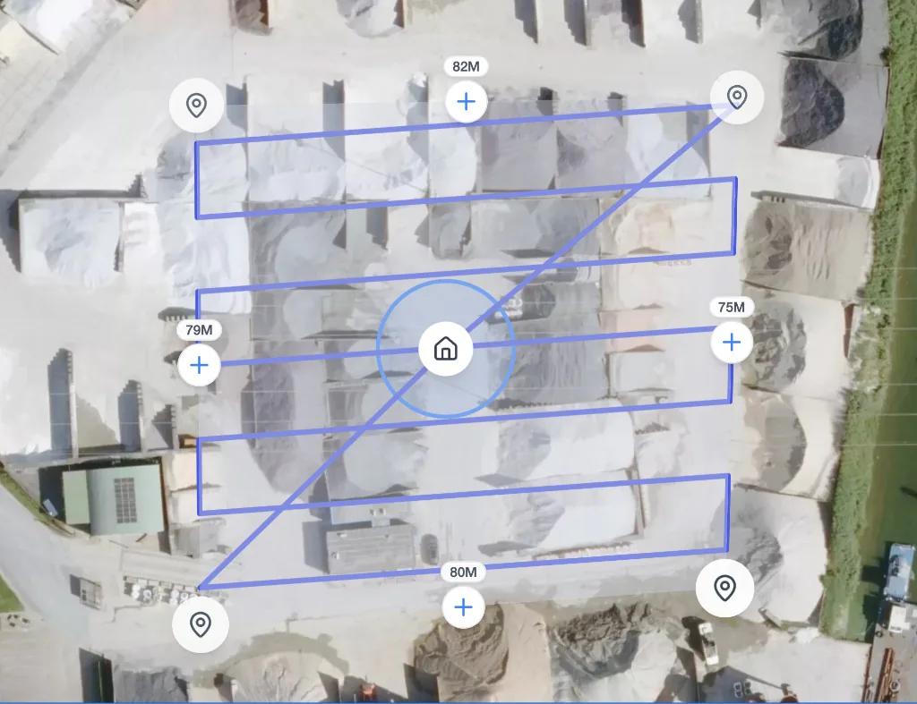
From flight to result in three steps
Our drone collects high-quality data fully automatically. All you have to do is place the drone and press start. The rest happens on its own.
Place & plan
Place the drone and simply mark the area to be measured in the software.
Automatic flight
The drone flies the mission fully autonomously and collects all the required data.
Receive results
After about 20 minutes your first measurement results are ready in the dashboard.
Built to use every day
Simple enough for everyone on the work floor, accurate enough for the professional. That's why organisations choose AiroMap.
Book a free demoSimple
No steep learning curve and no complexity. Software that thinks along with you.
Accurate
Centimetre-accurate data with millions of measurement points and optional RTK correction.
Fast
Measure faster and receive the results right after the flight.
Always available
Measure whenever you need to, without depending on third parties.
Safe
Leave the heavy work to the drone and keep your people away from machines and risks.
Results from practice
From earthworks to recycling: organisations in the Netherlands, Belgium and Germany measure on their own every day with AiroMap.
It's easier than we expected.
The switch to accurate measurements became an advantage instead of a hurdle.

Within 20 minutes I have my first results.
We now measure ourselves, whenever we want, without waiting on an external agency.
Every sampler now delivers the same report, at a higher level.
Less manual work and reports that customers trust more.
Curious what AiroMap can do for you?
Leave your email address and we'll get in touch as soon as possible. Or schedule an online introduction right away.
Book a demo
Pick a time slot in our online calendar for a 30-minute introduction. We'll look at your situation together and show you what's possible in a personal demonstration.
Trusted by leaders in construction, recycling, infrastructure and more