


Start once. The rest takes care of itself.
AiroMap is the only platform that brings flying, processing and reporting together in one simple whole. A fully automated process from start to finish, without standalone software or manual data processing.
From start to result, without manual intermediate steps:
Press start
You select the site and press start. The drone then begins flying automatically.
Automatic flight
The drone takes off by itself, flies the calculated route and lands again. Fully autonomous.
Automatic upload
During and after the flight, the drone uploads the imagery automatically to the cloud via 4G.
Processing in the cloud
The cloud automatically turns the imagery into the data from which you create your report.
From as little as 20 minutes after the flight, your result is ready in the browser. Anyone on your team can do it, with no prior knowledge or drone experience.
One platform, any device, anywhere in the world
AiroMap works on all your devices in exactly the same way. The same simple controls everywhere, with nothing to install.
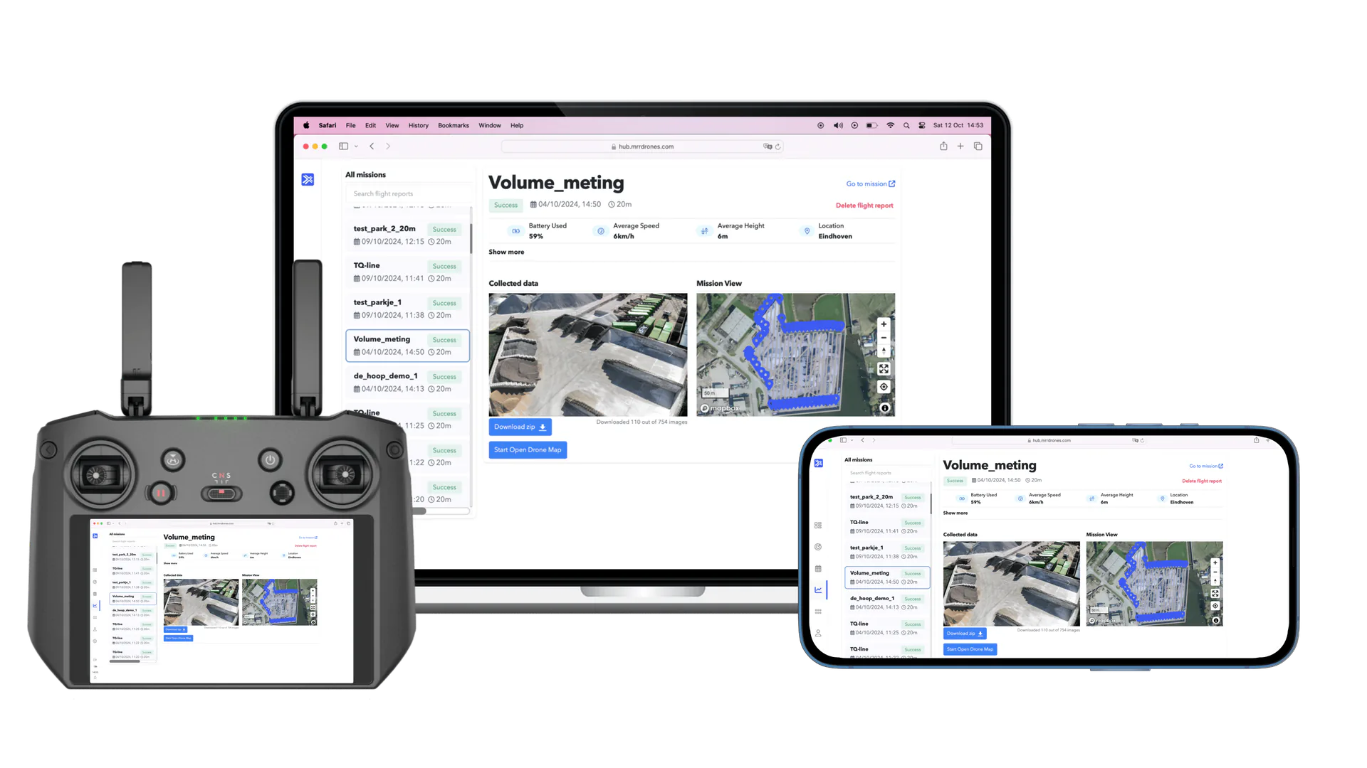
On any screen
Laptop, remote controller or phone: the same app, the same buttons. No separate versions to learn.
Nothing to install
Everything runs in the browser. Log in and you are in. Updates happen automatically.
Accessible anywhere
Your surveys are stored securely online. View and share them wherever you are, from the site to the other side of the world.
Simple on the outside. Smart on the inside.
We have moved all the complexity into the background, so you do not notice any of it. For you it stays simple, while smart technology does the work behind the scenes. This is what sits beneath the simplicity.

A UI you understand right away
We believe good software explains itself. AiroMap shows only the buttons you really need. No menus full of options, no hundred-page manual. Everyone on your team is up and running within half a day.
- Clean, modern interface without clutter
- Only the steps you need
- Operable with minimal training

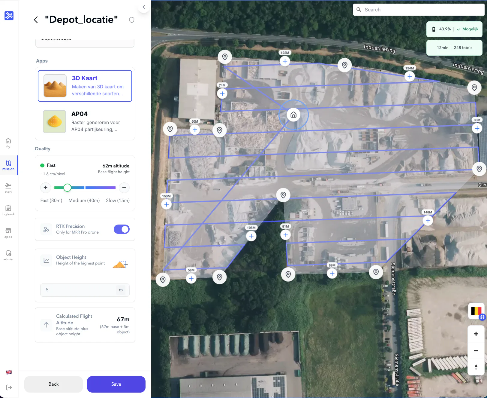
Route planning that does the thinking
Draw the area you want to survey and the platform calculates the optimal flight route itself: the right altitude, overlap and photo coverage for a sharp and complete 3D model. The algorithm takes the shape of your site into account, so every square metre is captured.
- Optimal route and photo coverage, calculated automatically
- Full coverage, even on irregular sites
- Every survey follows exactly the same, repeatable process
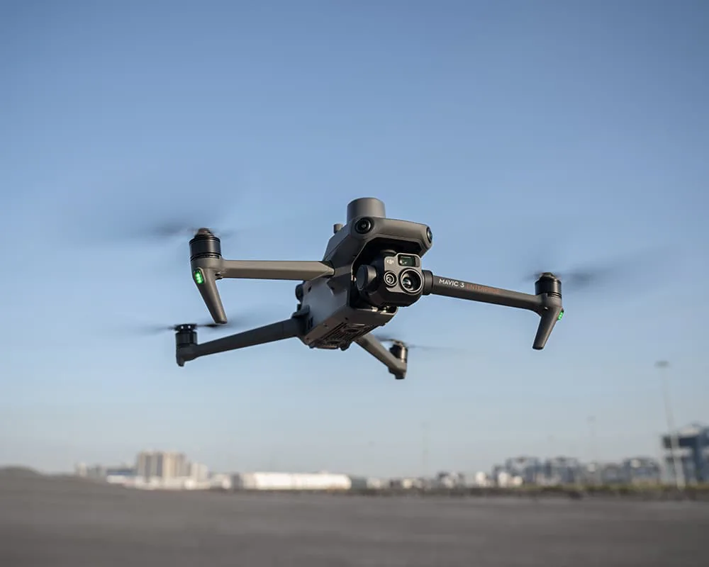
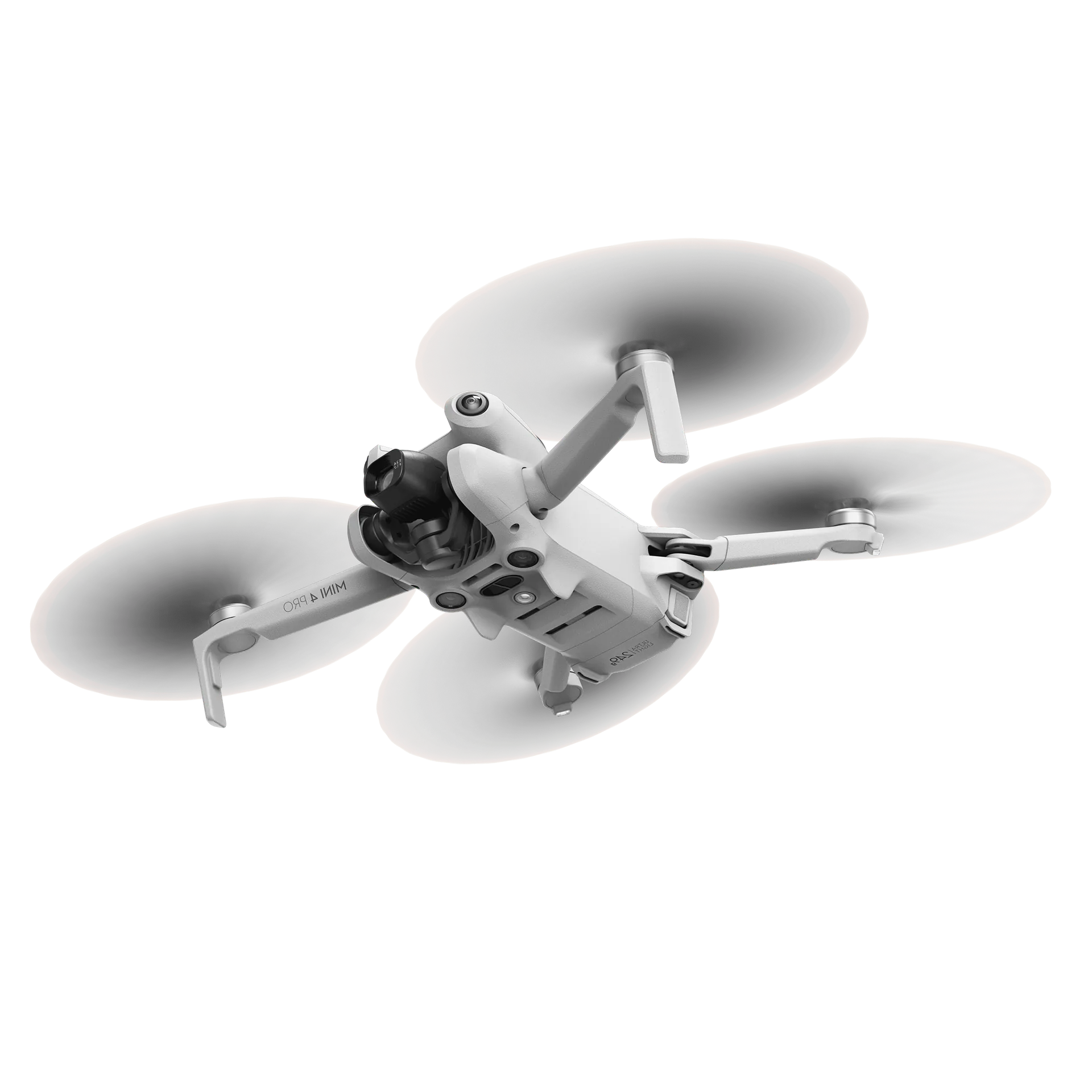
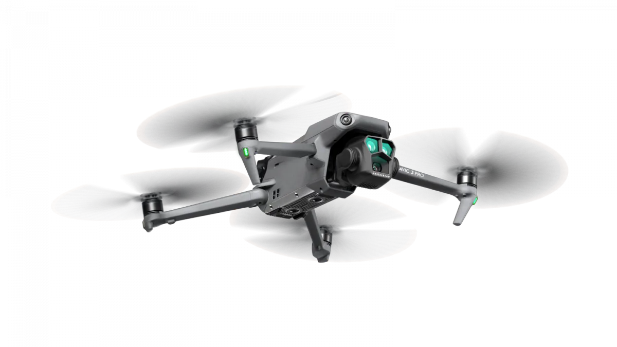
Our own autonomy on board the drone
Our unique autonomy software runs on board the drone and controls the entire flight, from take-off and flying the route to landing. During the flight the software keeps the drone continuously under control and sends live information via 4G to the platform, so you follow the flight in real time. This way the drone carries out every survey itself, without a pilot and without manual correction.
- Our own flight software controls the drone continuously, without a pilot
- Take-off, flying and landing are fully automatic
- Follow the flight live via 4G in the platform
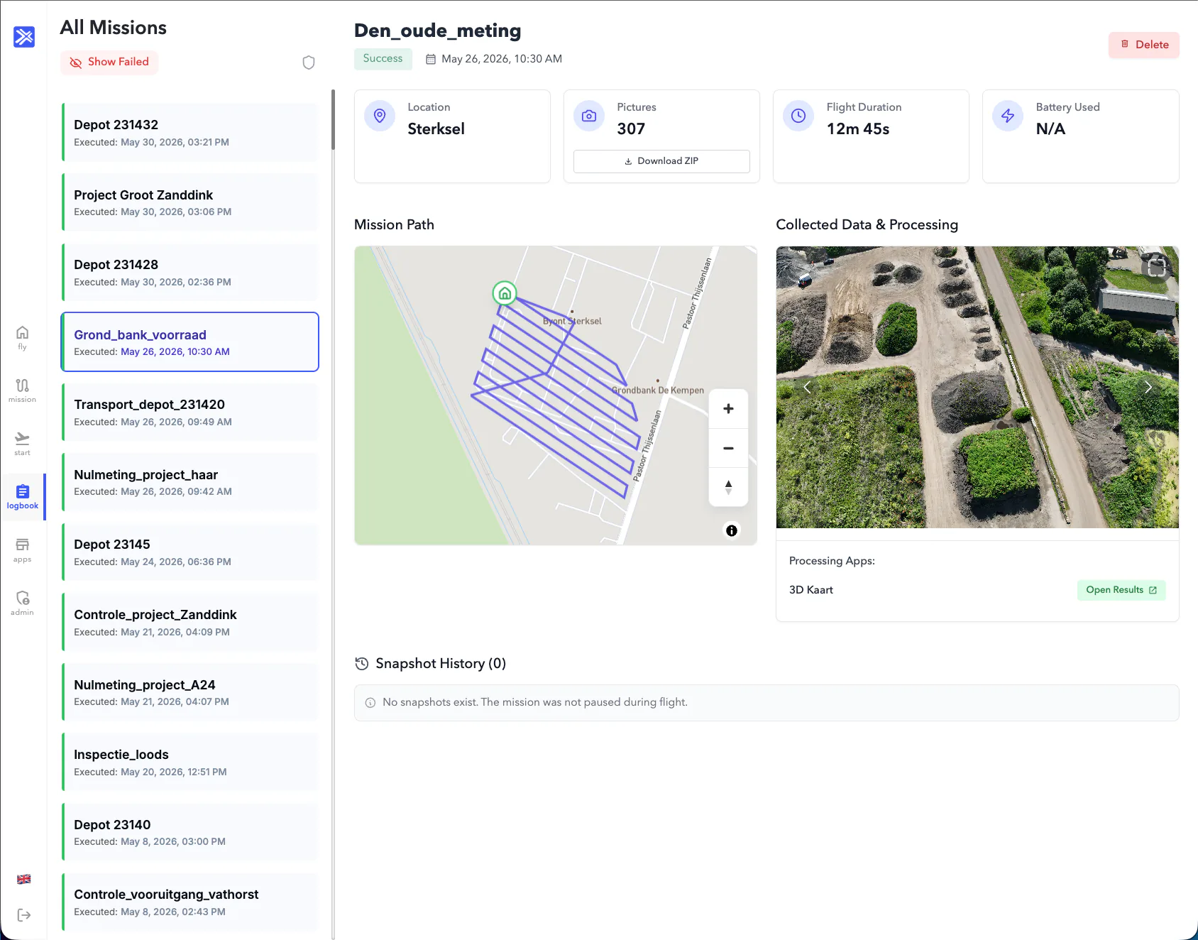
One platform full of apps
AiroMap collects the data from each flight and runs various apps on it. With the 3D app you collect 3D data and with the AP04 app you generate a BRL1000 grid. Each app has its own purpose this way. The cloud does the computing and you open the result straight in the browser.
- One platform with apps for a wide range of uses
- New apps expand the capabilities of your existing drone
- Result ready in the browser, no heavy computer needed
Apps that grow with you
AiroMap is built up from separate apps that all work on the same flight data. This way the platform grows along with what you need.
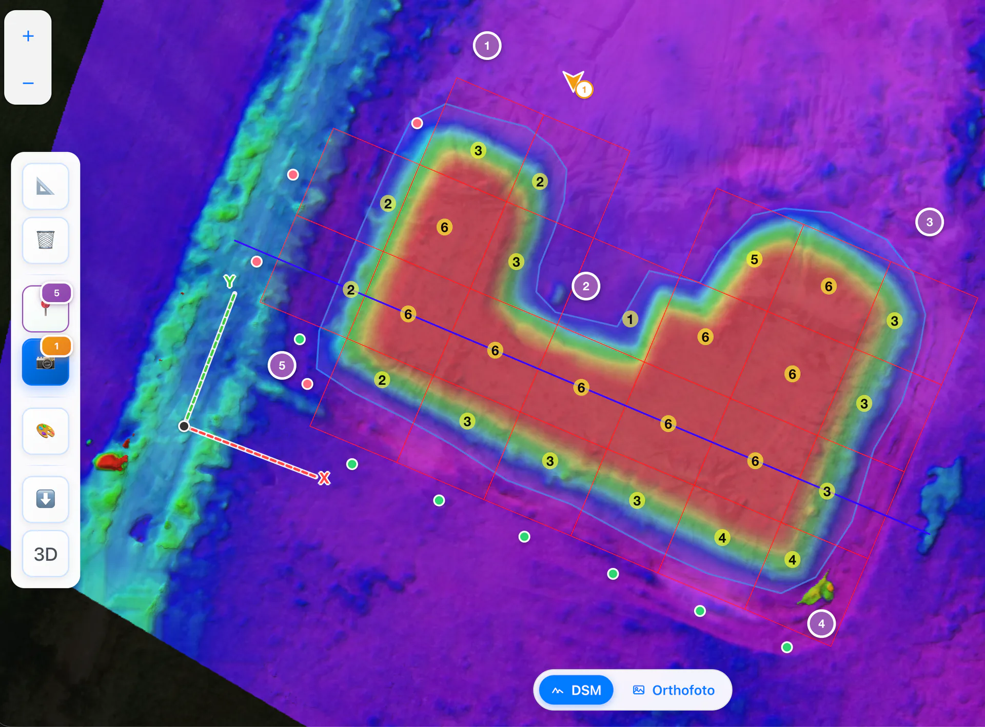
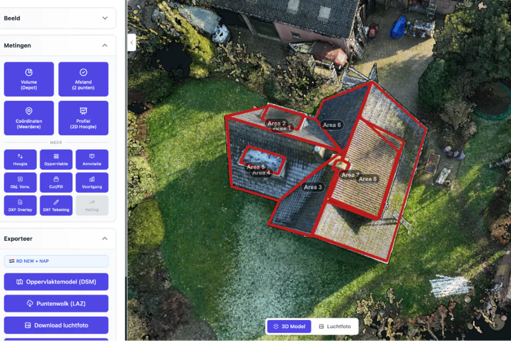
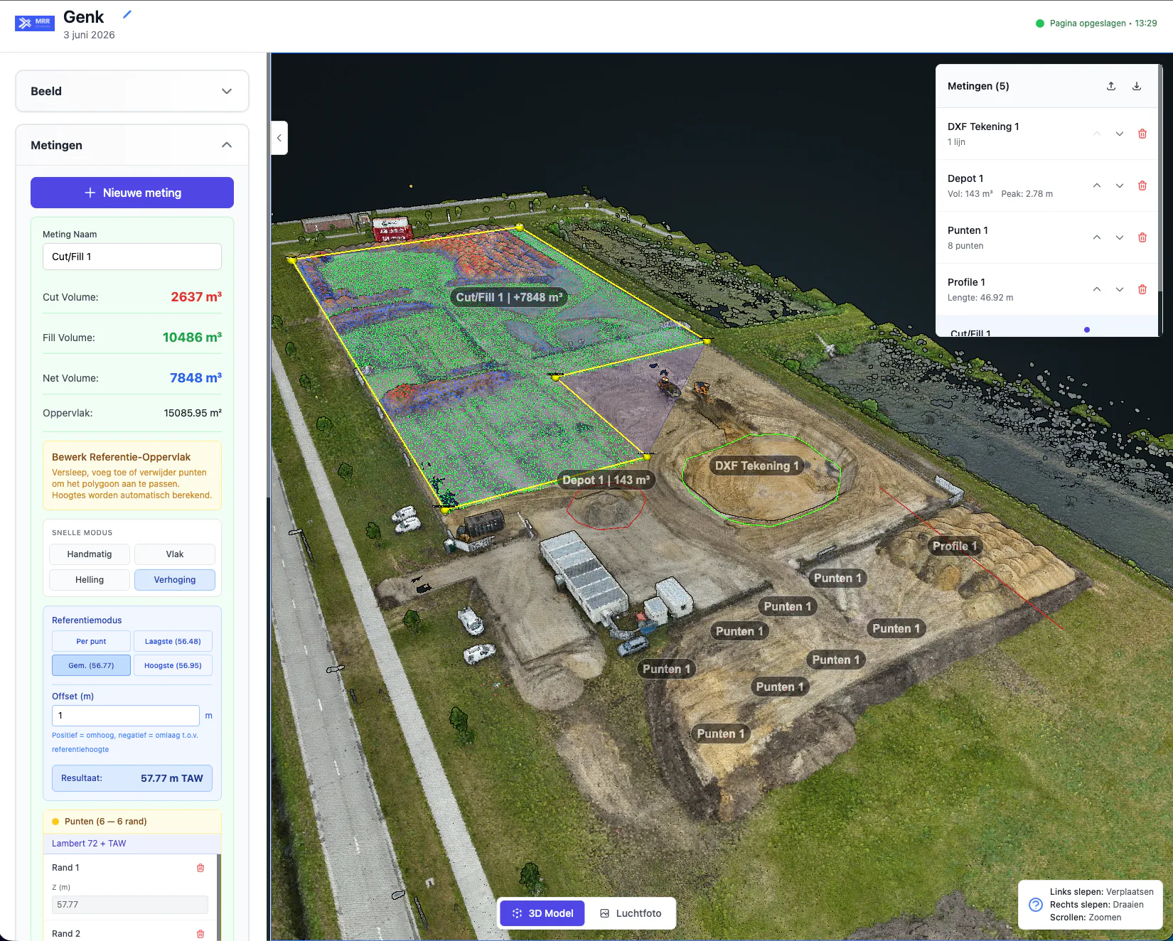
3D Model
Our all-in-one survey tool. Carry out all kinds of measurements on your 3D model, compile reports and export to your CAD software. The engineering tool for construction, earthworks and more.

AP04
Made specifically for batch inspections. Automatically generates the BRL1000 grid, the volume calculation and the cross section in line with the AP04 guideline.

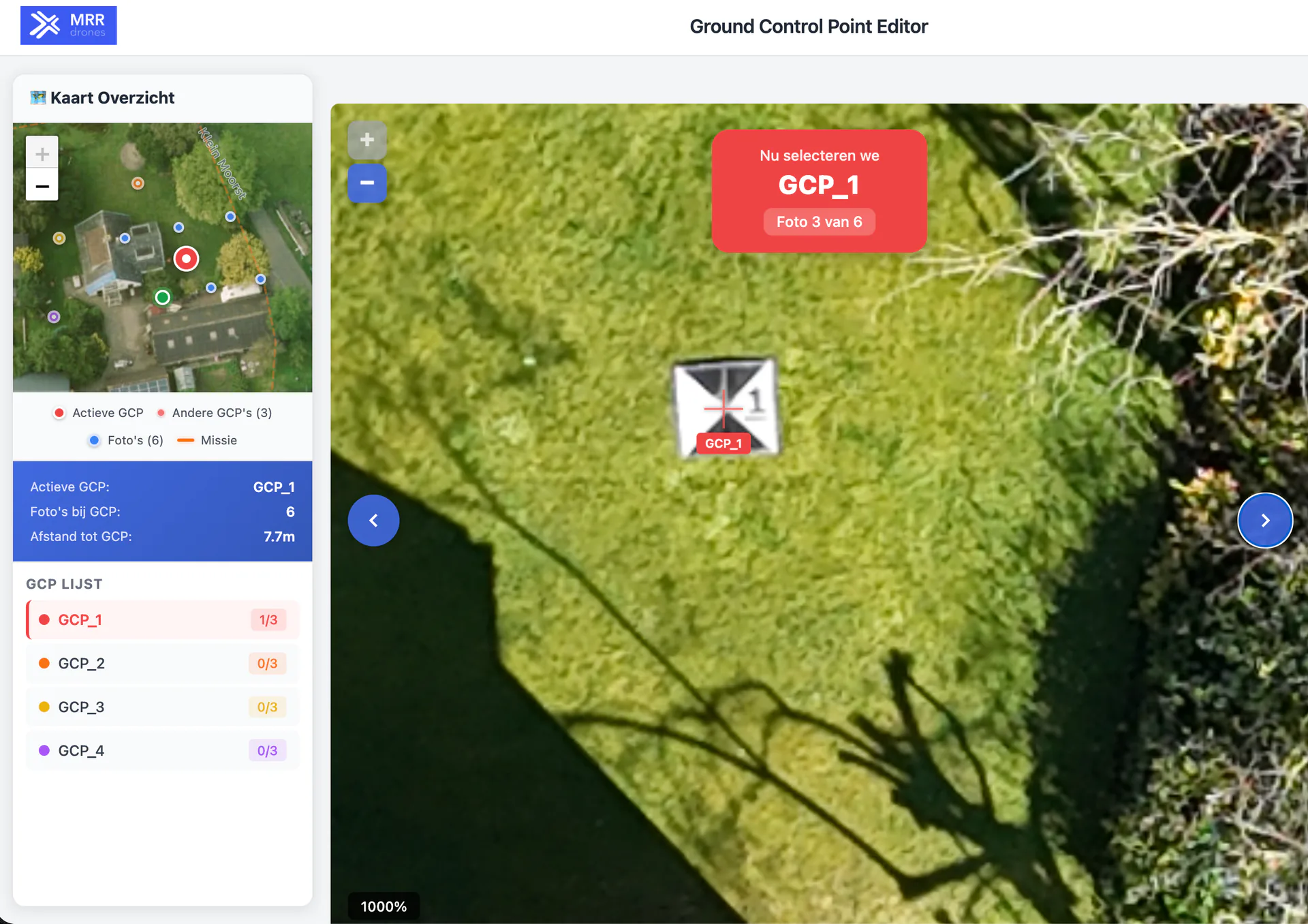
GCP
Increases 3D accuracy for survey-grade projects. A simple, highly automated GCP workflow, fast and hassle-free.

Projectopvolging
Compare 3D surveys over time and archive them in a structured way. Keep projects clear and see exactly where and when something deviates.

Foto
Creates a fully automatic, accurate, georeferenced aerial photo of your area.
 AI
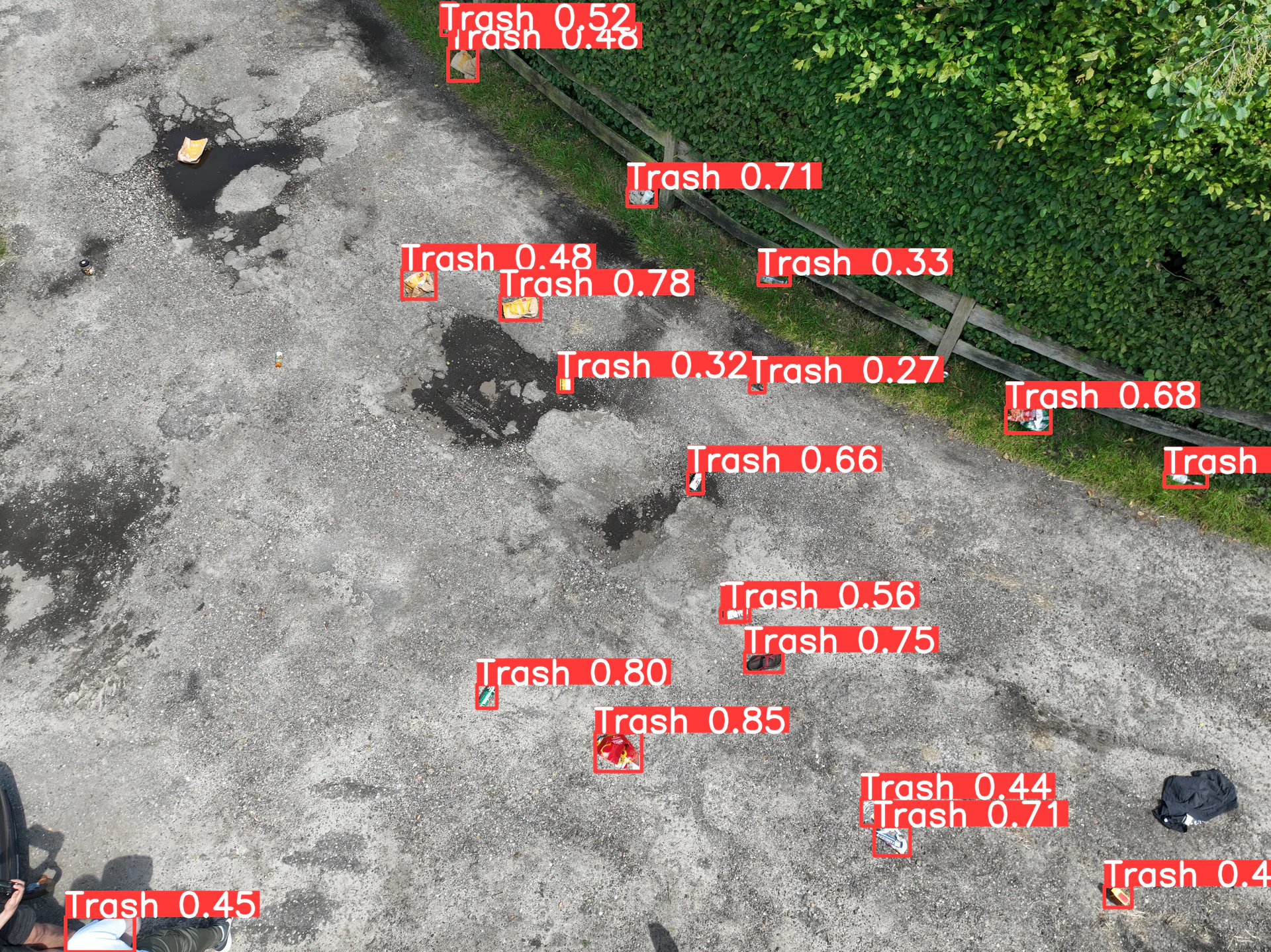
AIAfvaldetectie
AI-driven detection of waste on aerial imagery. Based on geolocation it generates a heatmap that shows where the most waste lies.
 In development
Dakinspectie
3D mapping of the exact shape and curvature of complex roofs. For roofers to quote accurately and inspect roofs for damage.
And more are on the way
The platform keeps growing. Do you have a survey need of your own? We think and build new apps together with you.
Automatically monitored, from take-off to landing
Flying fully automatically is only possible if it is also safe. That is why AiroMap checks the flight automatically, before, during and after the survey. You do not have to check anything yourself, the platform monitors safety automatically.
Everything checked before start
- Battery, GPS and connection checked
- Weather and wind assessed
- Geofence and flight area confirmed
Monitored live in the air
- Position and altitude continuously tracked
- Stays within the set area
- Safe automatic landing on deviation
Quality checked
- Imagery checked for coverage and sharpness
- Automatic restart if something is missing
- A result only once the data is correct
And this comes as standard in the platform too
Multiple drones
Manage multiple drones and locations from the same platform. This way you scale up easily.
Cloud platform
All your surveys and reports are stored securely online and can be shared with a few clicks.
Everything linked
Reports, models and volumes are automatically attached to the corresponding flight. Nothing gets lost.
One platform that fits your work
One simple platform for very different use cases.
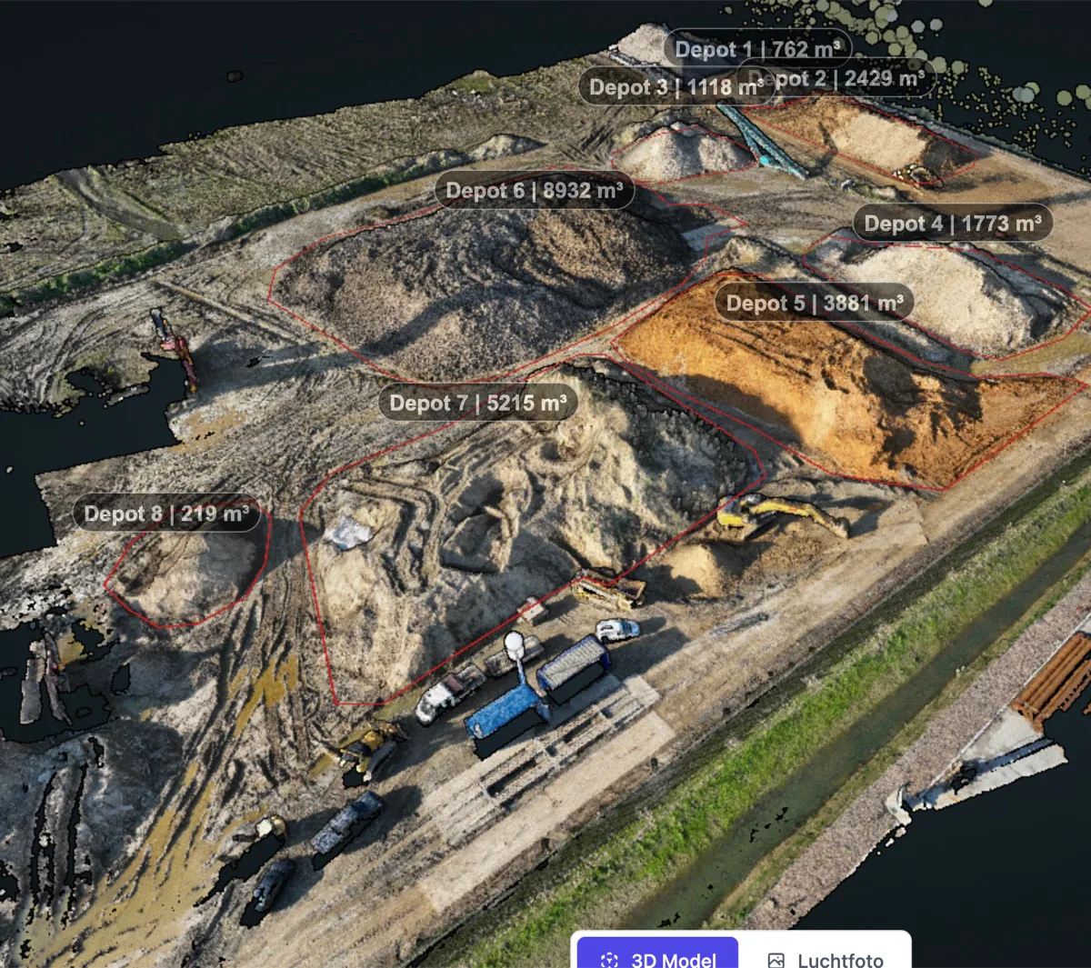
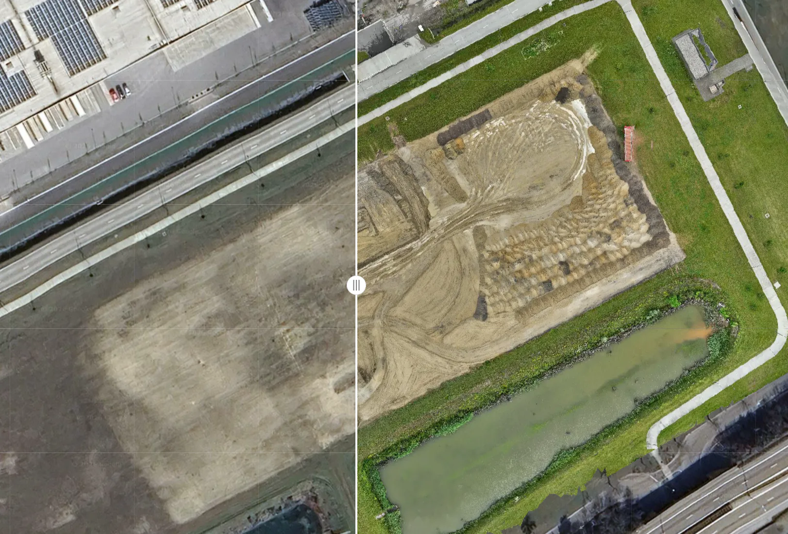
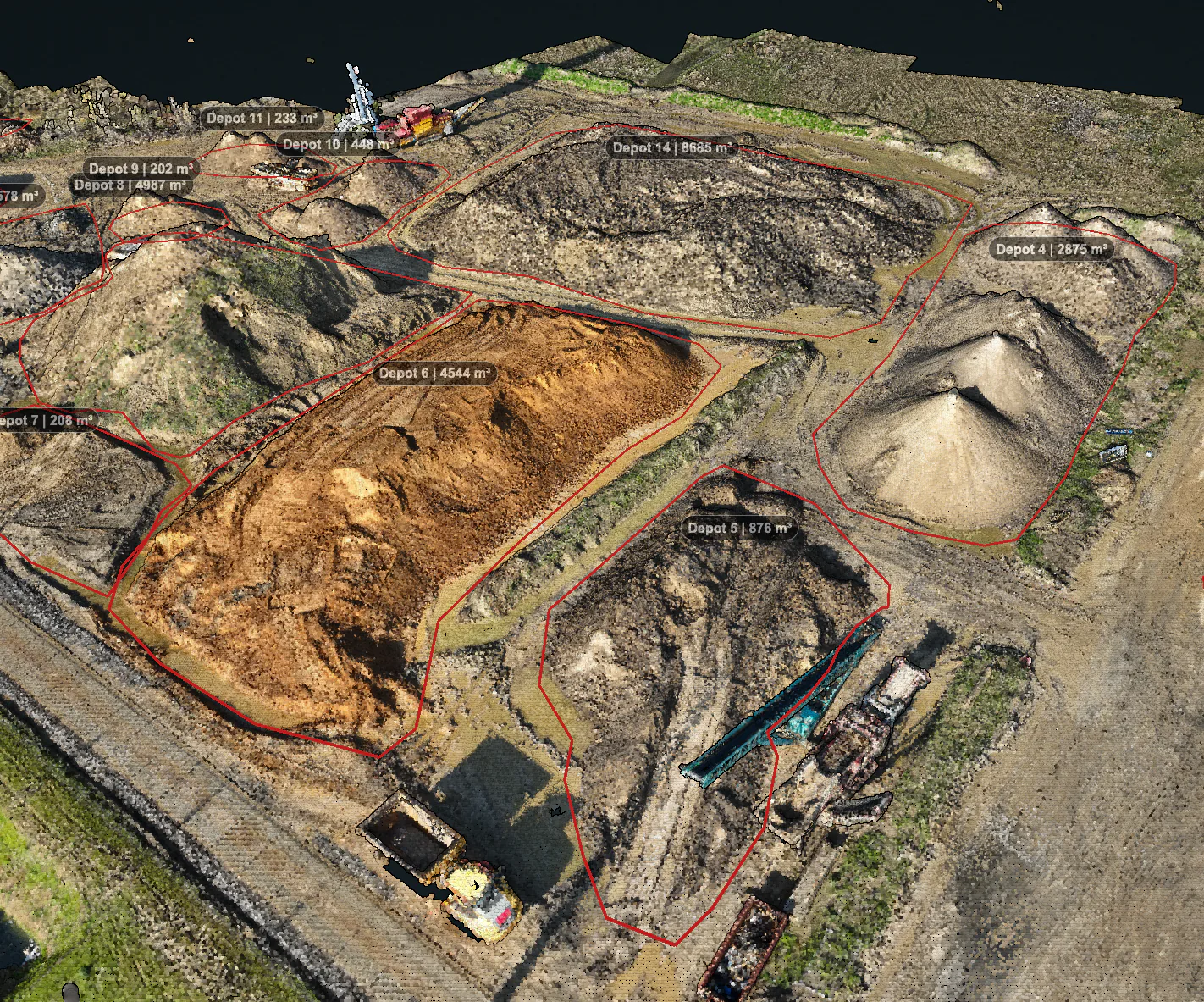
Stock & volume measurements
Measure exact volumes of stockpiles and bulk flows within minutes. No more manual estimates and no debate about quantities.
View use case
Civil engineering & infra
Always up-to-date 3D models for planning and progress. Measure heights, calculate cut/fill balances and overlay the design onto reality.
View use case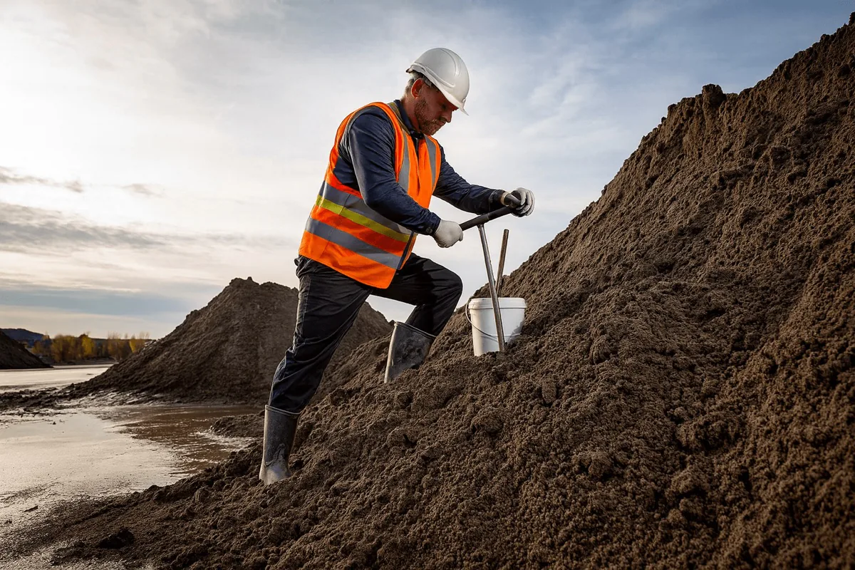
AP04 batch inspections
Automatic measurements following the AP04 guideline. Fully documented and ready to use for sampling and reporting.
View use case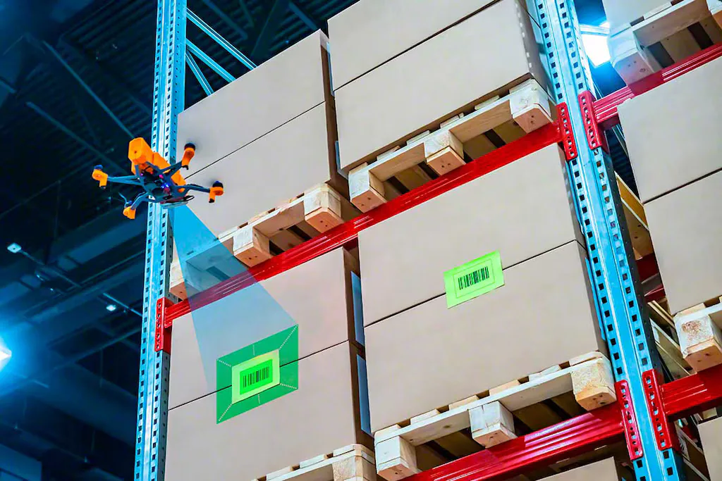
New applications
A different measurement need in mind? Through new apps AiroMap expands to extra use cases — think roof inspections. We think and build along with you.
View use caseSee the platform in action for your own use case
You only truly understand how simple and powerful AiroMap is when you see it for yourself. Book a free demo: together we look at your use case and show you the entire process, from flight to result.
Curious what AiroMap can do for you?
Leave your email address and we'll get in touch as soon as possible. Or schedule an online introduction right away.
Book a demo
Pick a time slot in our online calendar for a 30-minute introduction. We'll look at your situation together and show you what's possible in a personal demonstration.