Trusted by leaders in earthworks, infrastructure and road construction
In use at, among othersThe biggest risk is what stays invisible
The trade is changing. Designs are getting more complex, tolerances tighter and clients increasingly ask for exact proof. At the same time margins are thin and people are scarce. As a result, one thing becomes more important than ever: an up-to-date, reliable picture of what's happening on your project.
Keeping the complete picture is hard
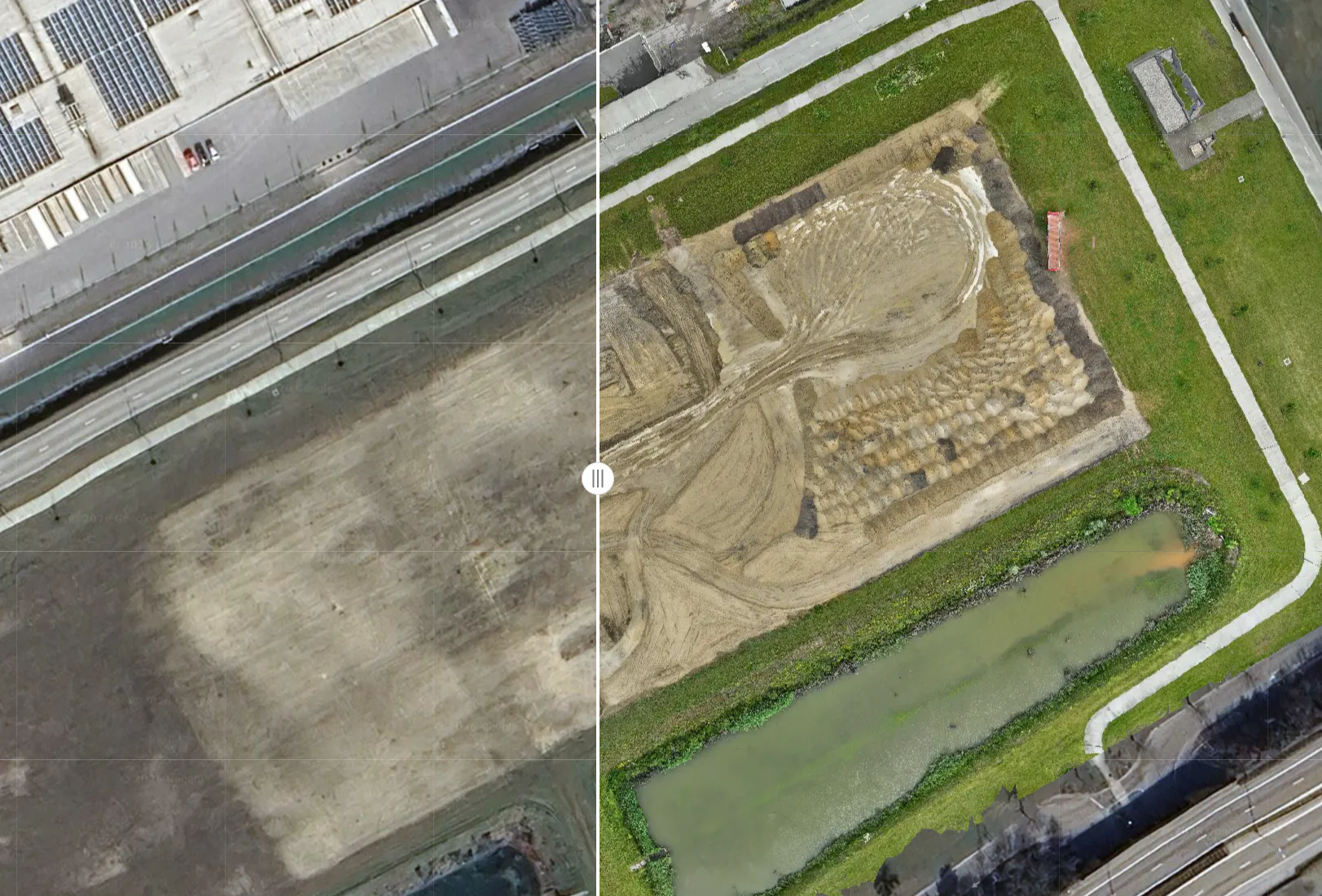
Exactly how much soil is there, does reality match the design and are we still on schedule? On a busy construction site, having an up-to-date and objective picture of that continuously to hand is difficult.
Deviations are noticed late
Margins in earthworks are thin. A height that's slightly off or a profile that's not right is sometimes only noticed late, and rework afterwards quickly costs 5 to 10% of a project.
More detail, fewer people
Clients ask for accurate work and detailed proof, while skilled people are scarce. Translating a complex design into a correct result in the field has to be right the first time, and efficient.
Want to know what's happening on your project right now? That's what AiroMap was built for.
One drone, one platform, your entire construction site in 3D
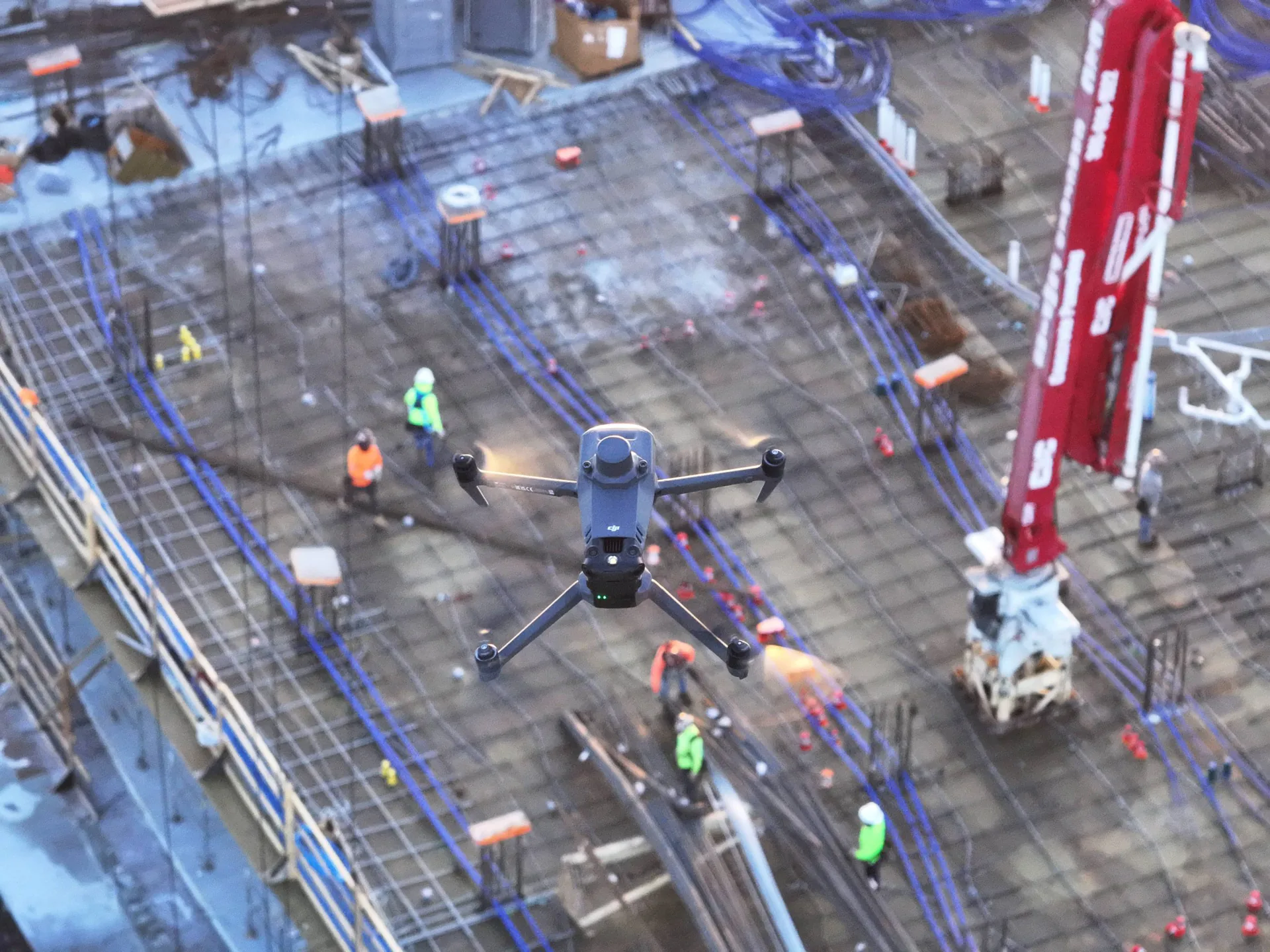
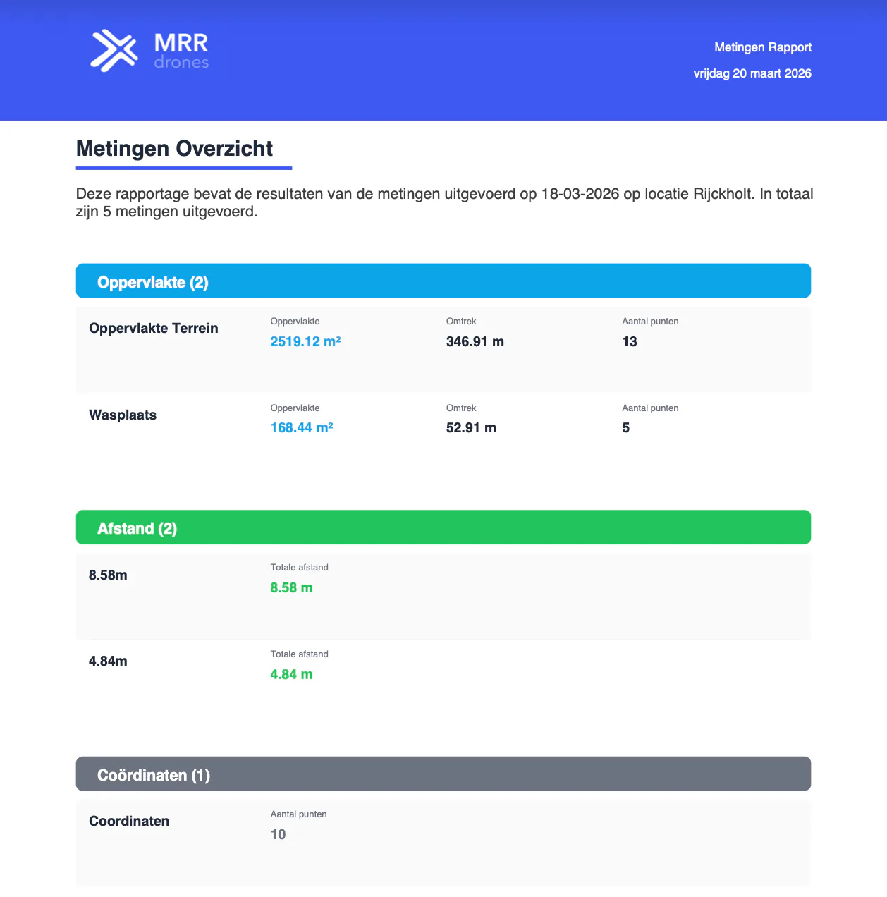
AiroMap is a complete measurement solution for earthworks and infrastructure: a drone that flies fully automatically, combined with a simple online platform for accurate 3D measurements. The drone flies entirely by itself and captures multiple hectares in ten minutes. In the online platform you then measure everything you need, from heights and volumes to the cut/fill balance. With automatic reports you easily share this information with your team.
Powered by the AiroMap platform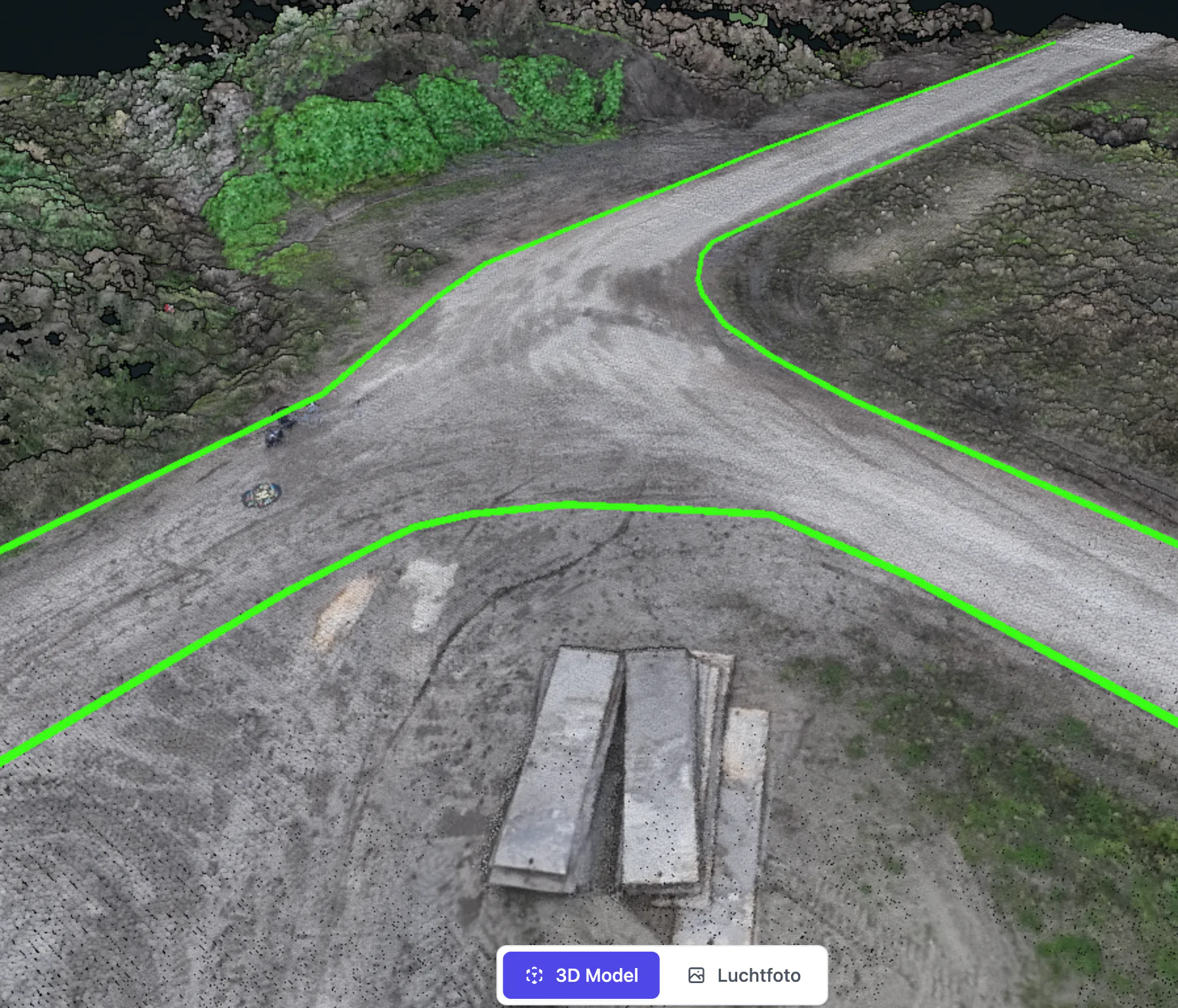

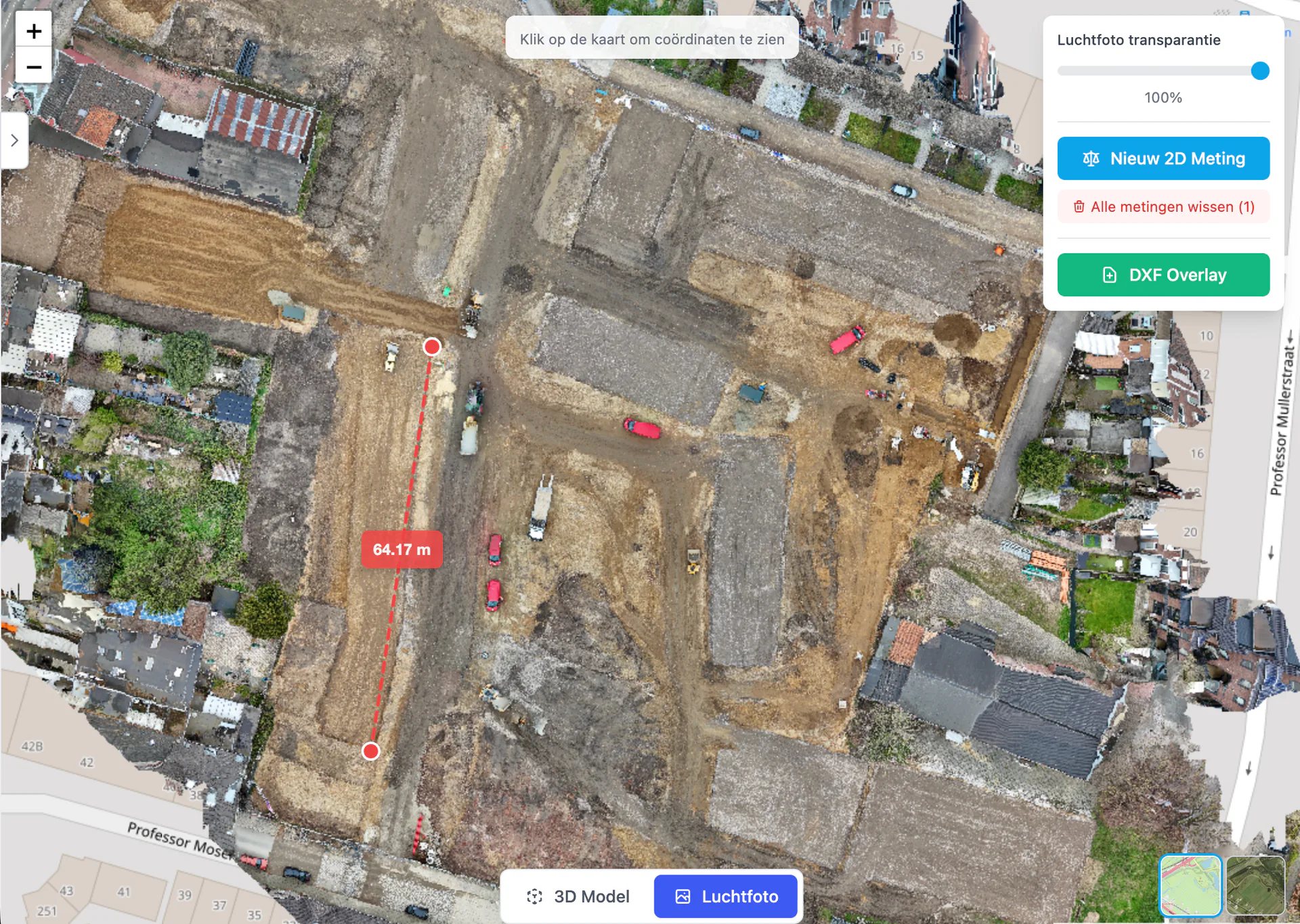
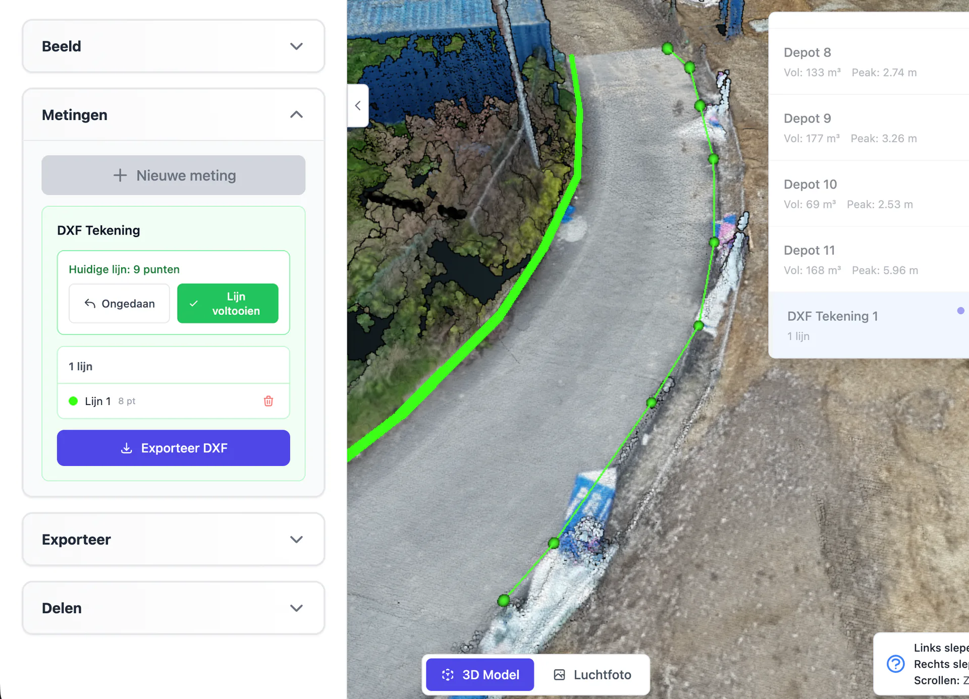
Overlay your DXF design as linework on reality and see immediately where it deviates.
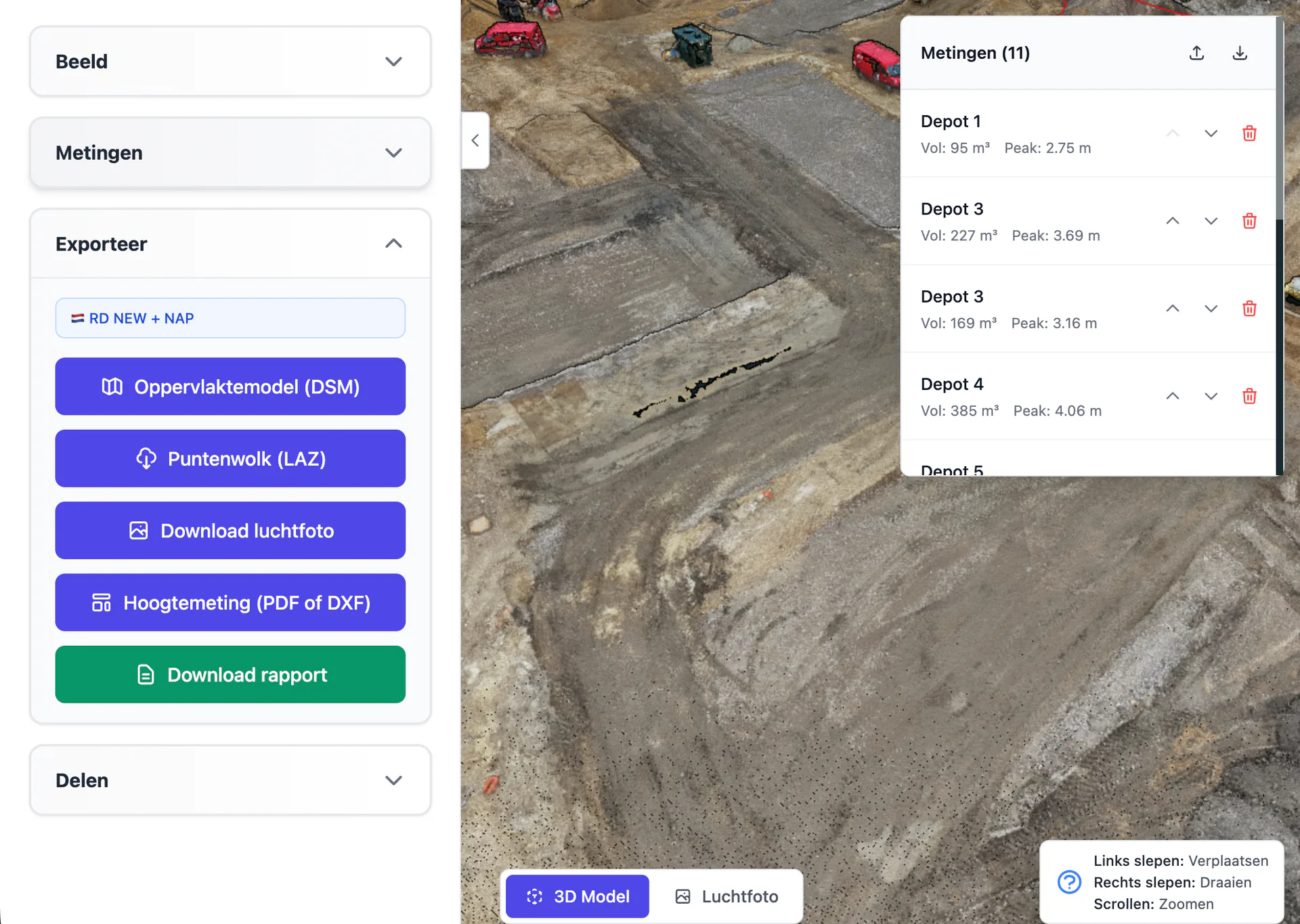
What the platform gives you
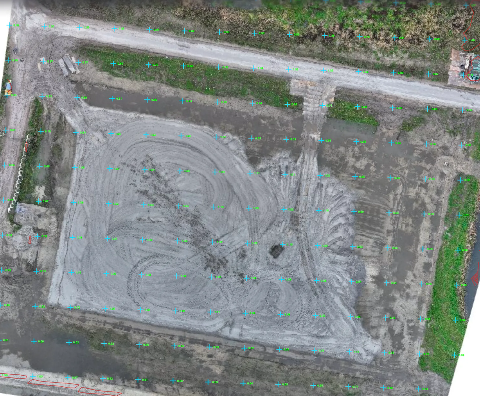
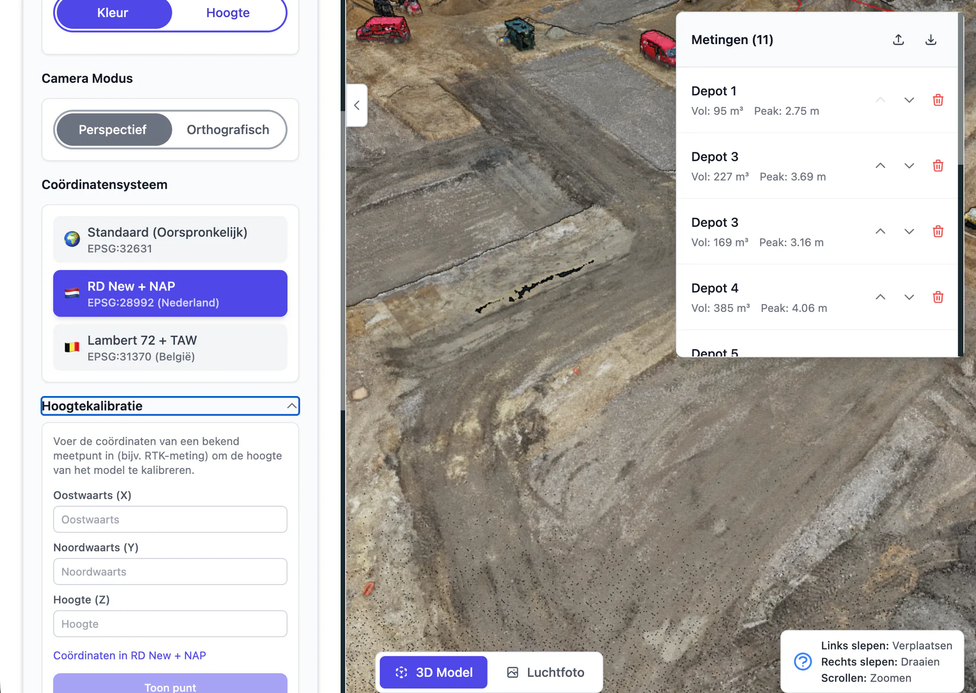
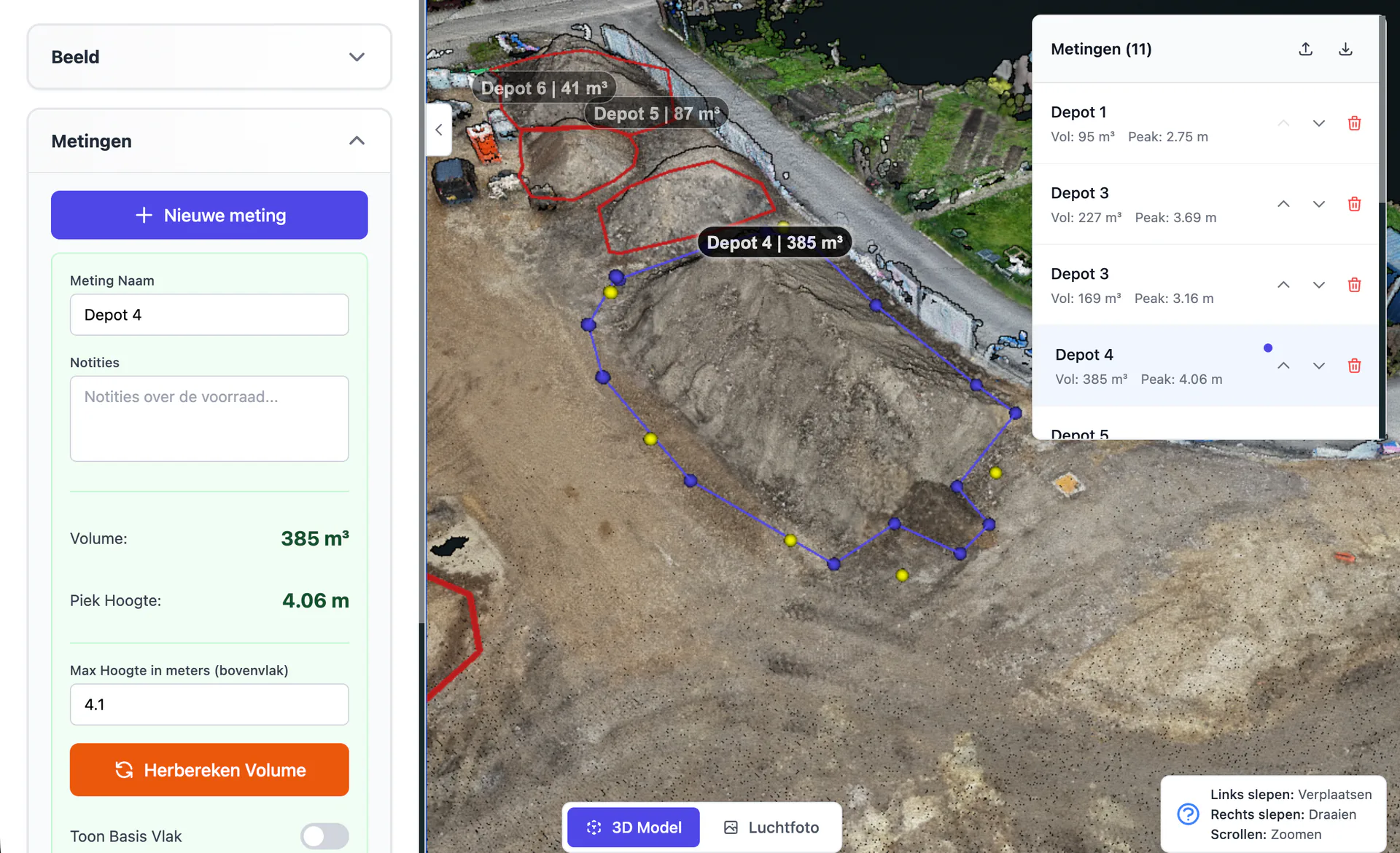
Accurate 3D model with heights
A complete 3D model with NAP heights as the basis for your cut/fill balance, planning and setting out.
Simple online platform
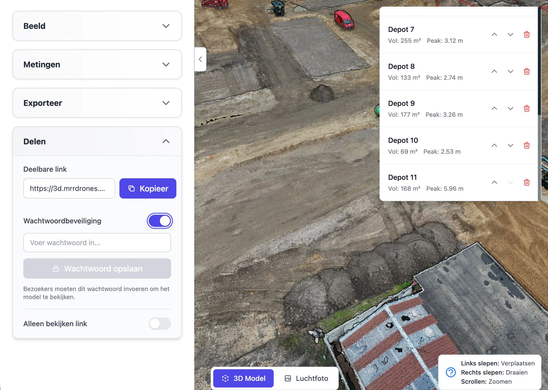
Easy to use. Share the entire 3D project via a link, or automatically generate a PDF or Excel report from it for colleagues and clients.
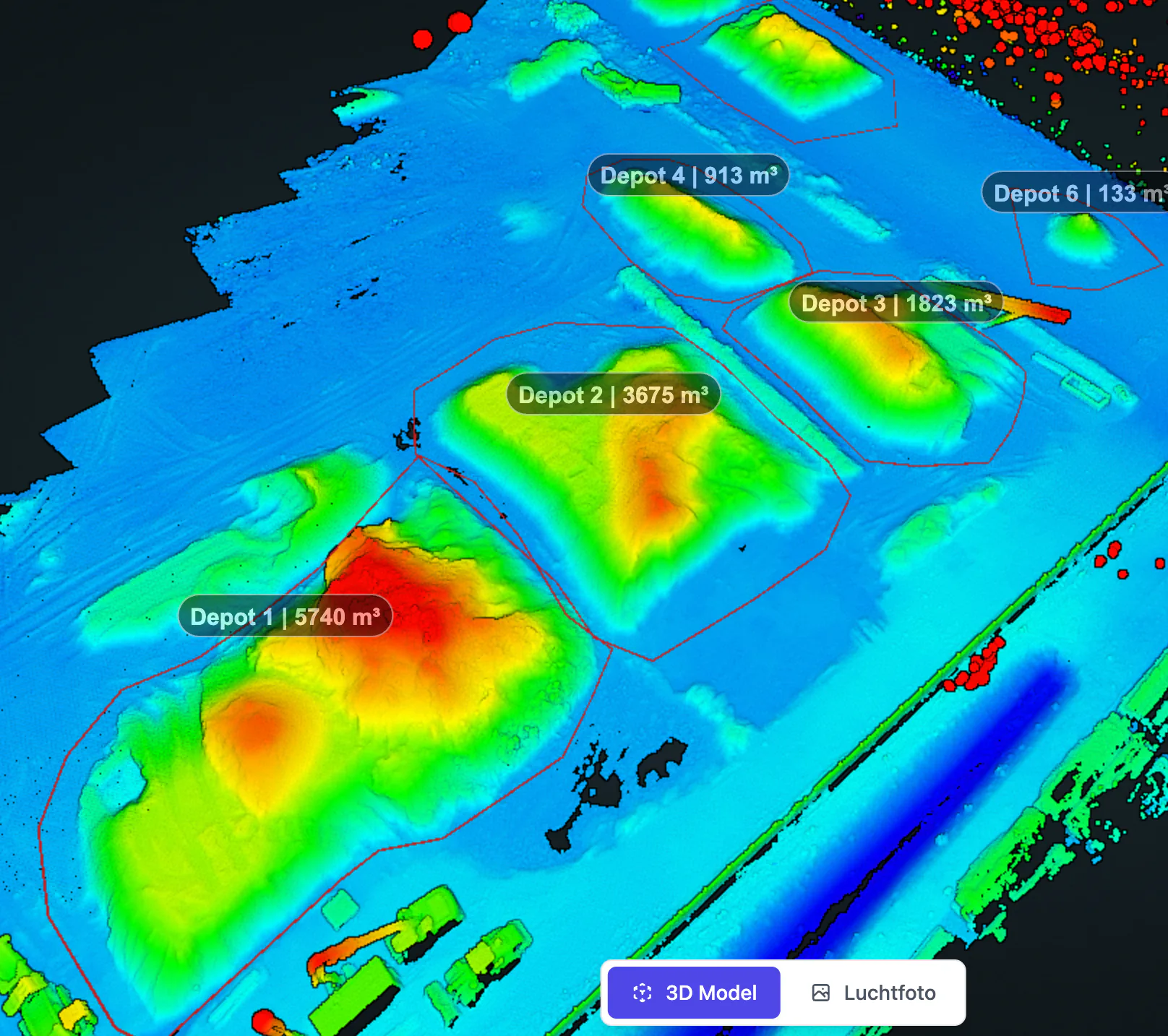
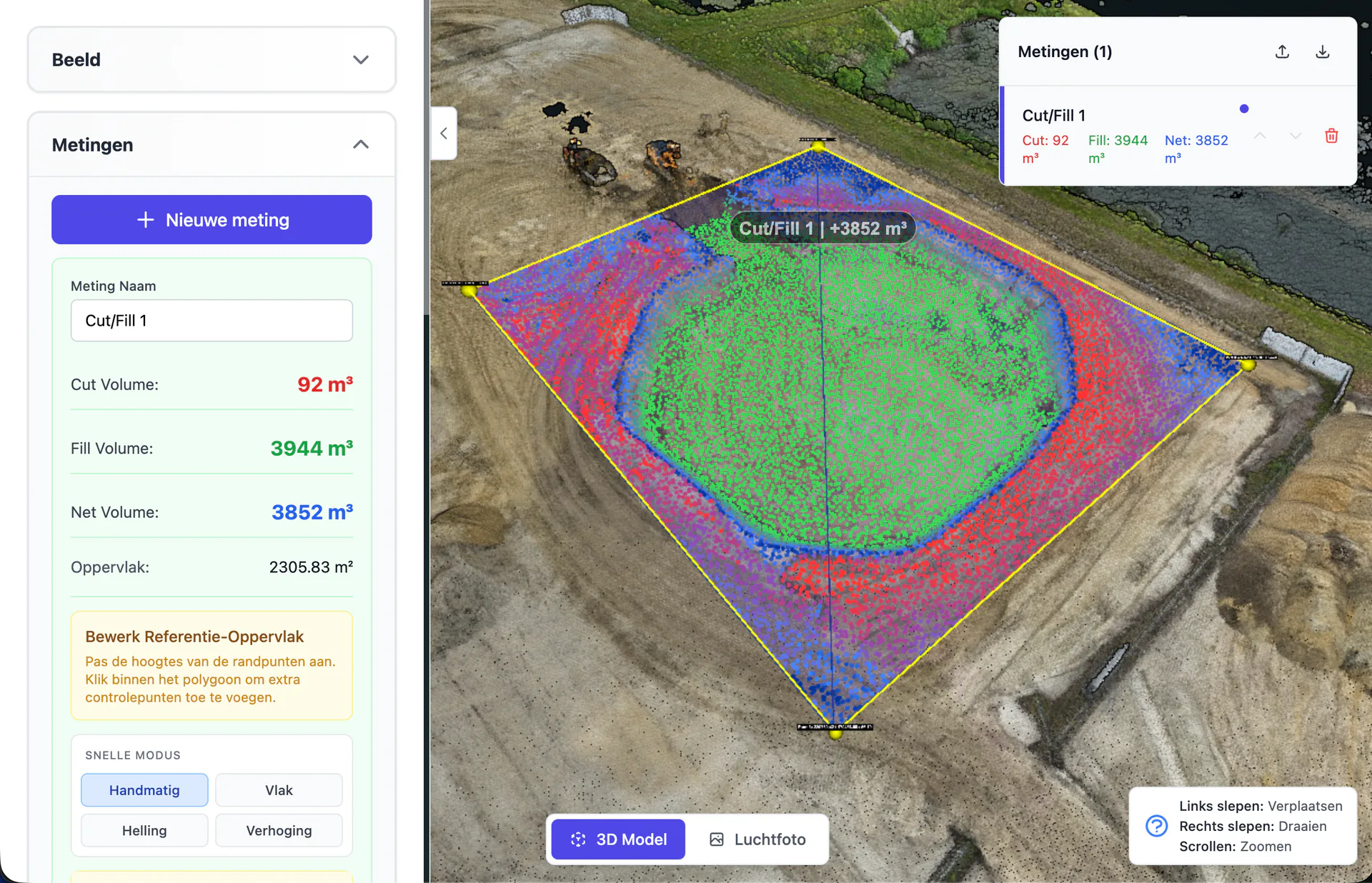
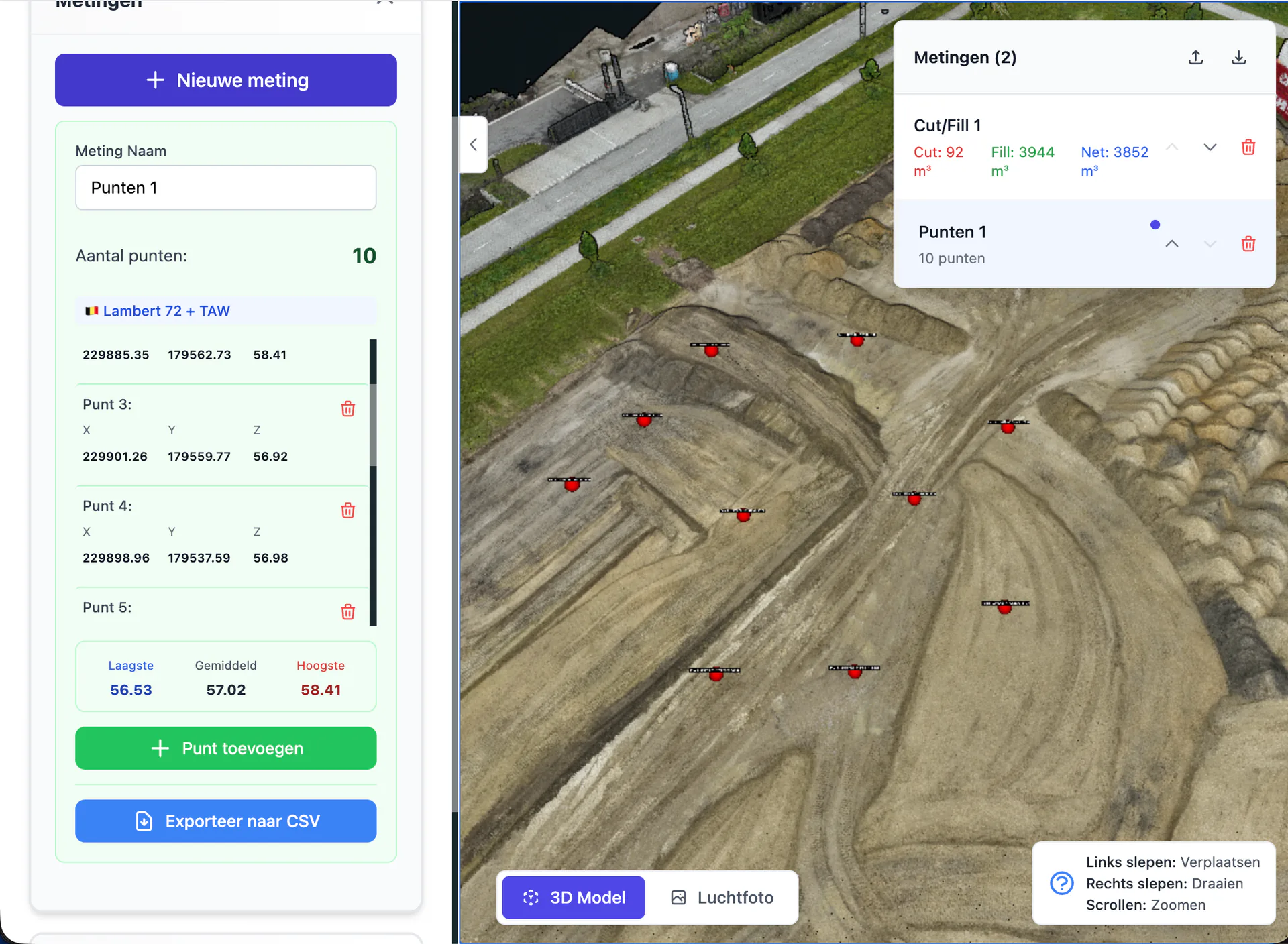
Advanced measurement functions
Measurements such as: cut/fill balance, stockpile volumes, profiles, coordinates, DXF linework and more.
Export to your workflow
Export as DXF, LandXML, GeoTIFF, LAS or CSV to Autodesk, QGIS and other software, or send data directly to your machine control.
From baseline survey to handover, with the same data
With AiroMap you have up-to-date 3D data in every phase of your project, from the baseline survey to handover. This creates a complete digital record of your entire project.
Baseline survey
Start with a 3D baseline survey of the site, including NAP heights, relief and distances. The digital foundation for your entire project.
Design & setting out
Use the baseline survey in CAD and pass the design through to the RTK-GPS or machine control. Everything connects seamlessly.
Progress & invoicing
Periodic scans show how much has been realised. Invoice on hard numbers and steer in time where it deviates.
Handover & as-built
Compare design and realisation in one click, deliver as-built data and hand over a complete digital archive to the client.
From up-to-date insight to higher margins
An up-to-date picture of your project is not a goal in itself. It translates directly into lower costs, faster payment and less risk.
Less rework, more margin
Errors and deviations become visible during construction, so you correct them in time without costly rework afterwards.
Invoice based on facts
Invoice on cubic metres actually moved and work realised, substantiated with hard data. Paid faster and no more disputes over quantities.
Control over your project from the office
Periodic flights show how much has been moved and how close you are to the design. Office and construction site work with the same up-to-date picture.
Proof and archive for later
Deliver as-built proof that you achieved the agreed result. And years later the digital archive still provides answers: how did that pipe really lie back then?
A complete system you control yourself
AiroMap is not a standalone drone and not a complicated software package. It's a complete system that your own people use when it's needed. That makes the difference for a positive ROI.
No external hiring needed
You measure everything yourself, without bringing in an external party. That saves costs.
Easy to use
No prior knowledge or drone experience needed. Thanks to on-site training, everyone on your team measures independently within half a day.
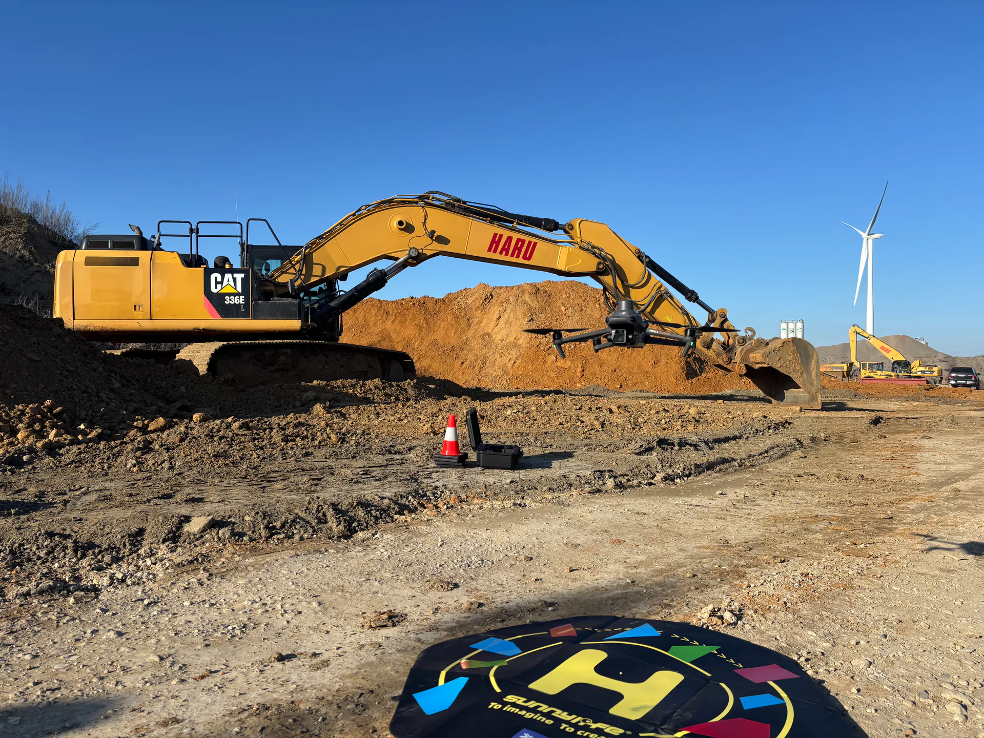
Fully automatic
The drone does all the flying itself. After the flight your 3D model appears automatically in the online platform.
On your own schedule
No calendars or appointments with third parties. You measure at the moment you need it.
Works together with your RTK-GPS
AiroMap and your RTK-GPS work together seamlessly.
One platform, unlimited users
Everything in one online measurement environment, without complicated software or extra licences. Everyone on the team views models, measures and creates reports.
One fixed monthly fee and unlimited measuring within your budget: the more often you measure, the lower the cost per measurement.
Everything in one package, operational within half a day
In one package you get everything you need: drone, software, training and everything around it. The drone flies fully automatically and thanks to our on-site training your team measures independently within four hours, without prior knowledge or drone experience.
And the measuring itself is fully automatic, in three steps:
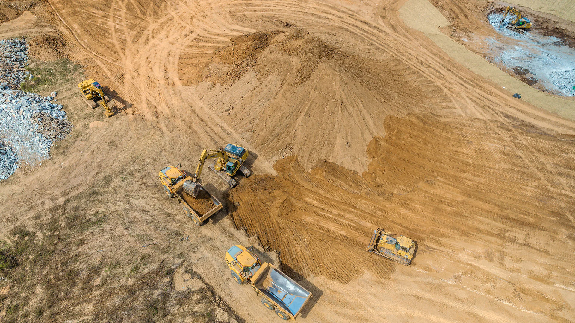
Haru measures weekly for volumes and progress
Haru, an earthworks and infrastructure company, deploys AiroMap on its projects. What started as a test, they now wouldn't want to be without.
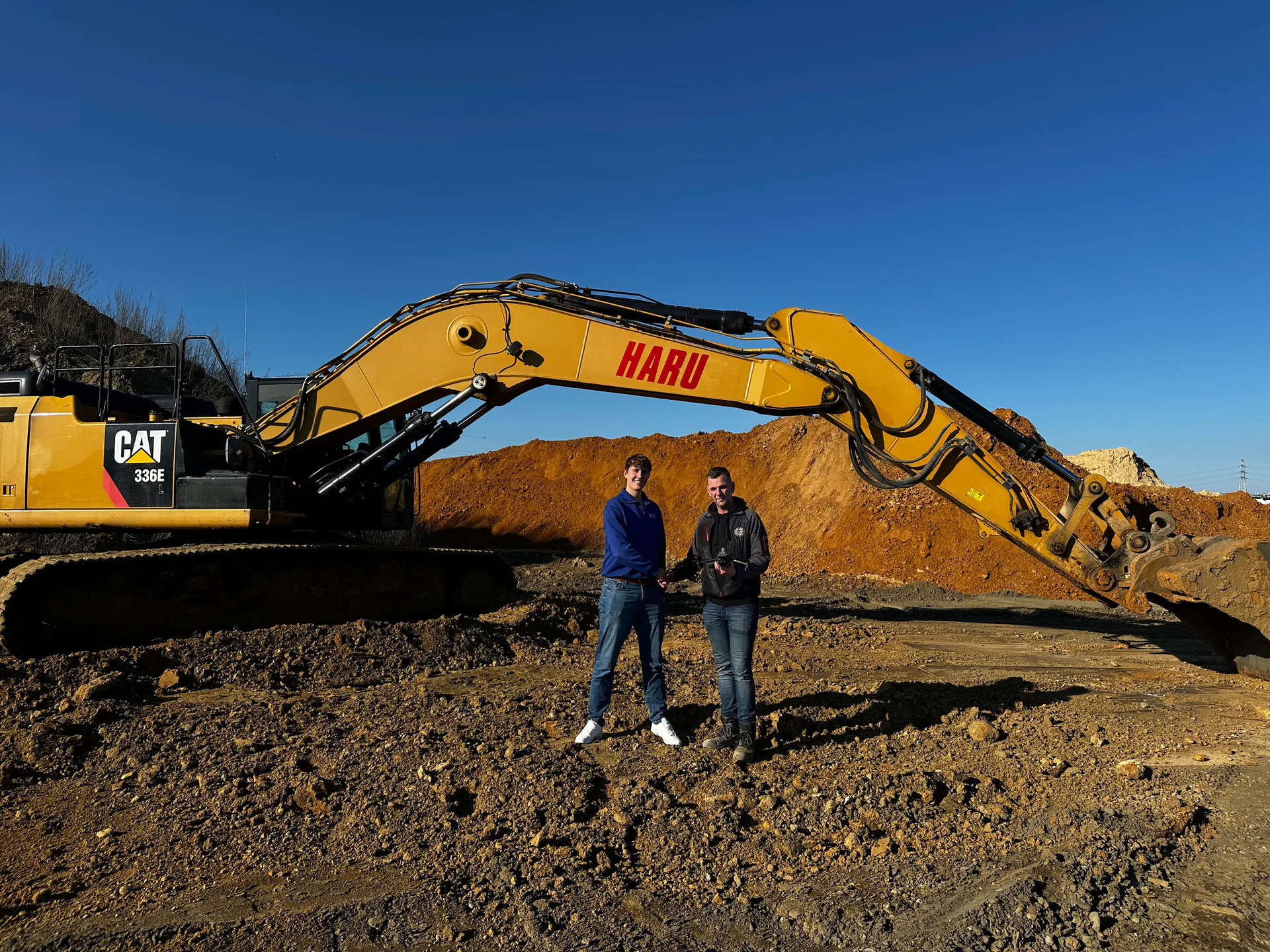
Haru deploys AiroMap weekly on its earthworks projects. The drone autonomously flies over the construction site and accurately calculates how much soil has been moved. This way Haru works with hard numbers instead of estimates and follows the progress of every project.
- Exact volumes as hard numbers, no more disputes over quantities
- Weekly flights for continuous visibility on progress
- Recorded how the work was carried out, as proof for later
“We first used the drone as a test, but by now we wouldn't want to be without it. With AiroMap's measurements we know exactly where we stand.”
Curious what AiroMap can do for you?
The real value of AiroMap is best seen in a demo. Book one without obligation: we'll look at your situation together and show you what AiroMap can concretely mean for your projects.
Curious what AiroMap can do for you?
Leave your email address and we'll get in touch as soon as possible. Or schedule an online introduction right away.
Book a demo
Pick a time slot in our online calendar for a 30-minute introduction. We'll look at your situation together and show you what's possible in a personal demonstration.