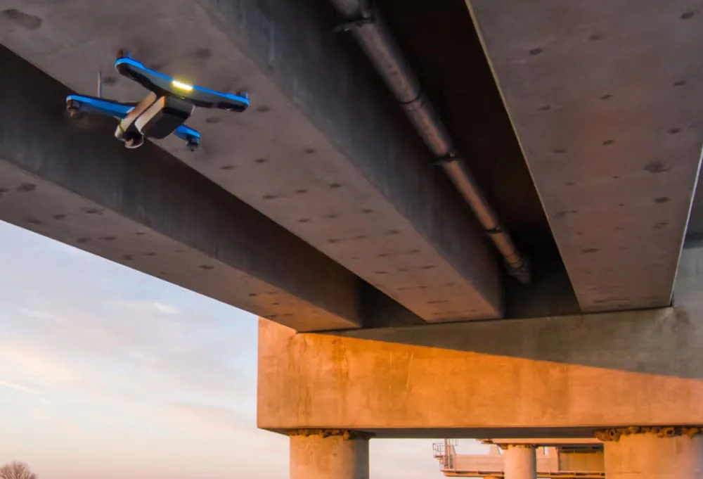
Inspections
Inspect bridges, roads, solar parks and industrial installations safely and repeatably from the air, including in hard-to-reach places. Deviations and maintenance become visible faster.
Not an experiment, but daily practice. We have been building automatic drones and our own AI for years.
From accurate volume measurements to AI image analysis: the platform you deploy today grows with you towards tomorrow's application.
The strength of AiroMap is that everything runs on the same foundation. The drone plans and flies every survey entirely by itself, captures reality in rich 3D and image data, and our AI turns it into usable answers. A new application is not a new device, but simply a new app on the same platform.
Powered by the AiroMap platform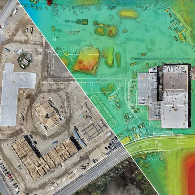
The drone plans the route and flies it entirely by itself. No pilot, no experience needed. Anyone on your team can make a recording.
High-resolution imagery and millions of 3D measurement points. The same flight provides the data for very different questions.
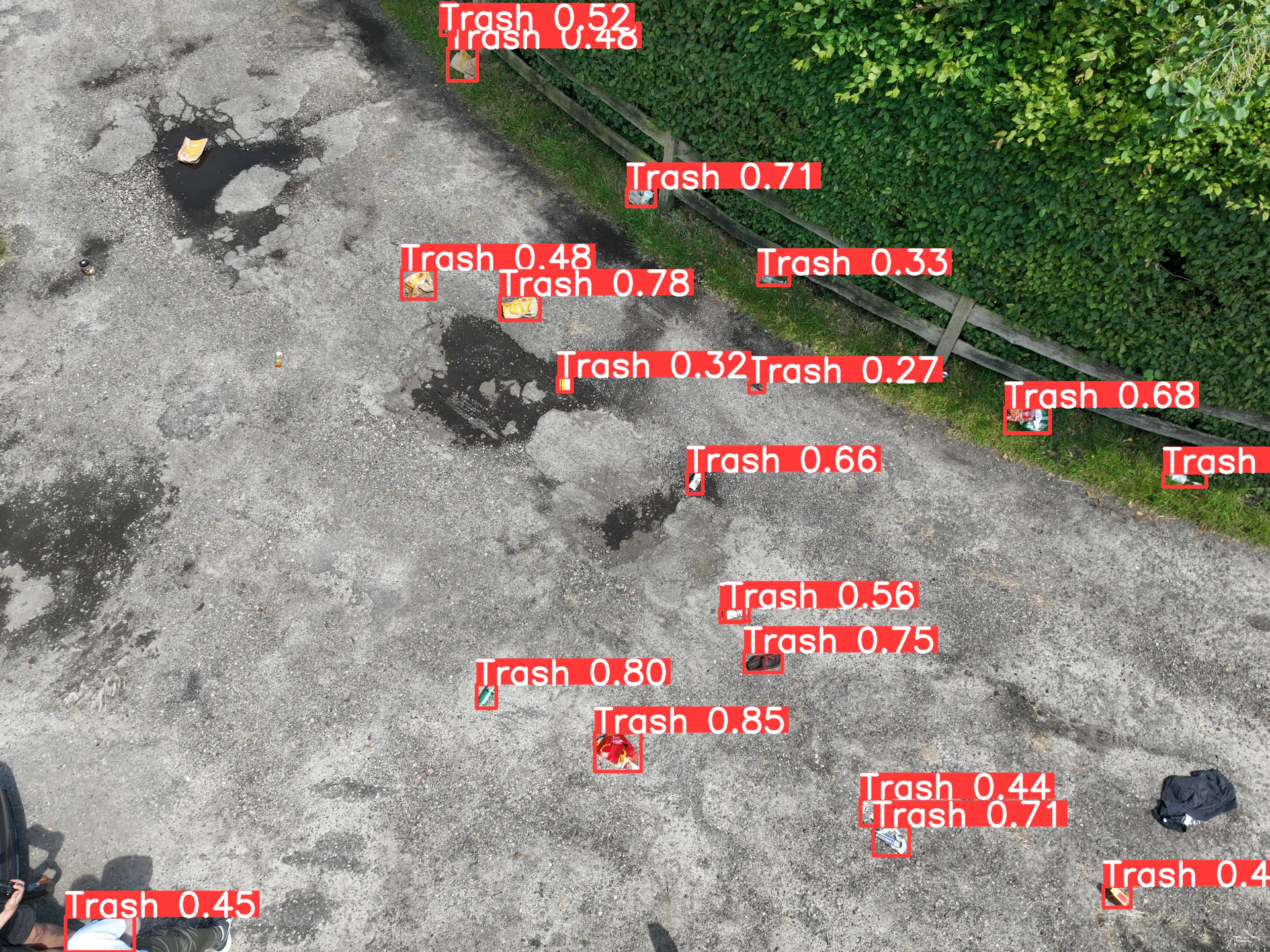
Our models automatically recognise, count and measure what is visible in the imagery. Consistent, fast and without manual work.
Do you have a new question? Then we build an app for it, on the same platform you already know. So your investment grows with you.
A drone captures imagery. Our AI turns it into decisions. We train our own models that automatically recognise, count and measure objects and spot deviations, across thousands of images at once. What takes days by hand, the platform does consistently and in minutes.
Objects, damage, waste or defects are automatically marked on the imagery, with a confidence score included.
Counts, surface areas and volumes are determined automatically. Not a sample, but the entire area.
Compare surveys over time and see immediately where and when something changes or deviates.
Results are labelled and summarised in a clear report, ready to share and follow up on.
A selection of the applications we have experience with. Is your question not listed? There is a good chance it is still possible. We are happy to think along with you on that.
Inspect bridges, roads, solar parks and industrial installations safely and repeatably from the air, including in hard-to-reach places. Deviations and maintenance become visible faster.
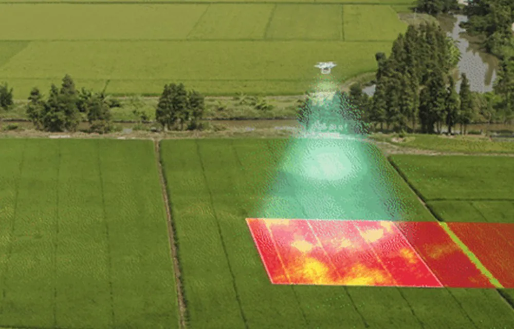
Crop monitoring, disease and stress detection, field analysis and seed breeding. Map fields repeatably and see insights that remain invisible to the naked eye.

Stock control, counts and inspections inside the warehouse, efficient and repeatable. We work on this together with Logicall, a leading European logistics player.
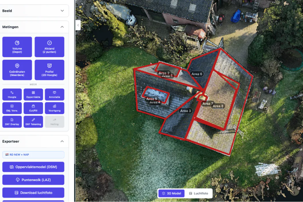
3D mapping of the exact shape and curvature of complex roofs. For roofers to quote accurately and inspect roofs for damage safely, without a ladder or scaffolding.
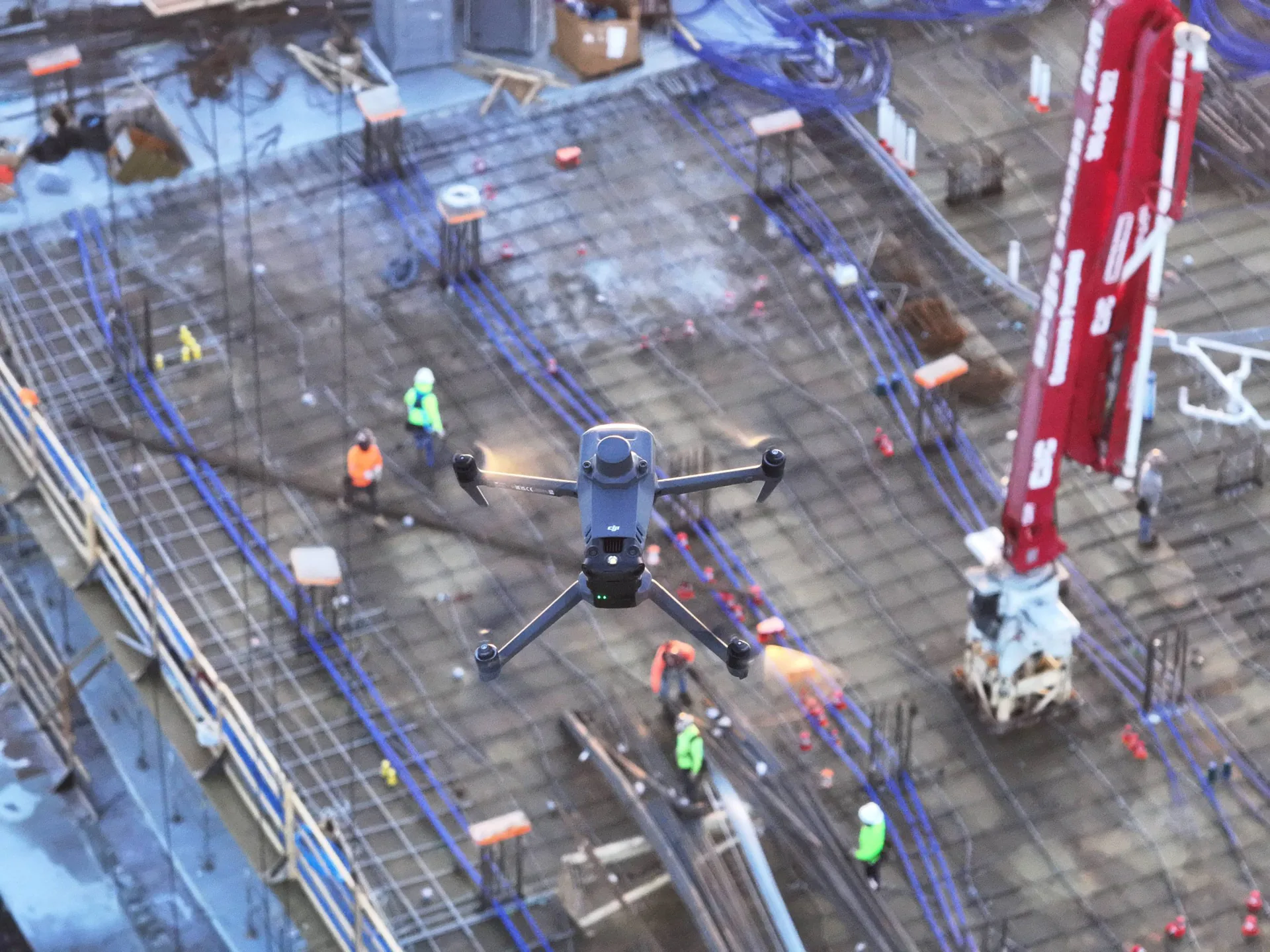
Think too of thermal inspections, security and site monitoring, progress on the construction site or a detection question of your own.
Do you have a specific question? Then we do not start with a quote, but with a conversation. Here is how we tackle it together.
We discuss your question and determine together whether and how a drone solves it best.
We fly a trial on your site and show what the data and the AI concretely deliver.
Does it work? Then we make it a fixed, repeatable part of your process, with training and support.
Whether you need a one-off recording or an ongoing solution: we scale with your question.
Tell us what you have in mind. Whether it is an inspection, an AI analysis or something completely new. We are happy to think along with you, no strings attached, and show what is already possible today.
Leave your email address and we'll get in touch as soon as possible. Or schedule an online introduction right away.
Pick a time slot in our online calendar for a 30-minute introduction. We'll look at your situation together and show you what's possible in a personal demonstration.