How a drone gets into a company
Buying a survey system is the easy part. Whether it gets used is the real question. How BK Ingenieurs took it up company-wide instead of as a trial.
There is plenty to say about the technology behind drone surveying, but in practice an implementation almost never fails on that. It fails on use. The system works, and three months later it is still in the cupboard.
This article is about how to avoid that, with the rollout at BK Ingenieurs as the example. Not because anything spectacular happened there, but precisely because it went smoothly, and that was not an accident.
Why survey equipment ends up unused
The pattern is the same in almost every failed rollout, and it has little to do with the technology.
- It becomes one enthusiastic employee's specialism. If they are away, nothing happens
- It is brought in as an innovation project rather than as part of the work, and innovation projects have no fixed slot in the week
- The people who have to use it in the field were not part of the decision, and see it as something added on top
- The office and the field have different pictures of what it delivers, so nobody really carries it
Notice that these are all organisational causes. The equipment does exactly what it should.
BK took it up company-wide
The most important decision at BK Ingenieurs was made before anyone had flown anything. They did not take it up as an isolated trial in one department but company-wide: the field staff were at the kickoff, along with the project management of the soil department, and IT.
That last one is the most striking. IT at a survey-system kickoff looks unnecessary, until you consider that the output has to end up somewhere: in reports, in existing systems, with people who will never carry out a survey themselves. Having them in the room from the start meant that never became a separate problem to be solved months later.
That sounds like a diary detail, but it is the heart of this story. As soon as several departments are in the same room, the conversation stops being about the drone and becomes about the work process: who surveys, what comes out, who uses that figure afterwards, and how it reaches the report. Exactly the questions that otherwise only surface when somebody hits them in the field.
The kickoff: software first, and mostly questions
We started in the office with the platform on screen. Not as a demonstration but as a walkthrough: how you set up a survey, what happens afterwards, what the output looks like and where it ends up.
The most useful part of that morning was the questions. With several departments in the room you get questions we could not have thought of, because they are about their process rather than our software. That is also exactly why we hold that kickoff before going into the field: it is easier to explain something once to a group than to repeat it separately four times later.

Then out into the field
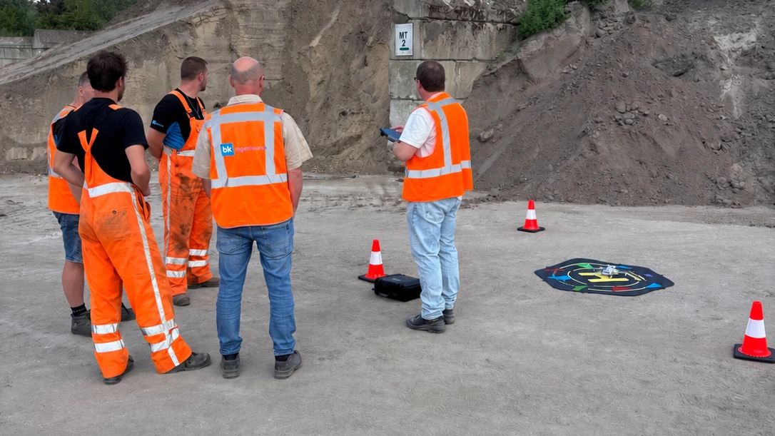
Explaining software on a screen is one thing. The real moment is outside, on a site where it will actually happen. That is where we had the field staff fly, in a situation like the ones they meet themselves.
None of the three field staff had flown a drone before. Zero experience. After roughly an hour everyone had done it themselves and everyone could carry out a survey independently. That is not a remarkable achievement on their part and not a sales line from us: it is what happens when the drone flies itself and operating it comes down to marking an area and pressing start.
The whole rollout, office and field together, took half a day.
What it looks like now
The drone is now in use weekly. That may be the most important figure in this whole story, because weekly use means it is no longer a project but part of the week.
What the field staff say about it themselves is strikingly often not about the drone but about what they no longer have to do. The calculation work that used to follow a survey, the working up and the checking, is gone. That was the least enjoyable part of the job, and it is precisely the part that fell away.
Which is also why it sticks. A system that adds work has to be kept going. A system that takes over the least enjoyable part of the work keeps itself going.
One figure instead of several
The second effect is one you do not see on the shop floor but do see in the organisation. Measuring a batch has traditionally been done by hand in this trade: measure up, draw it out, and calculate the volume from that. That is skilled work, and for a long time it was the only way. It is also a method where the result depends in part on who carries it out. That is a property of measuring by hand, not of the people doing it.
With a centimetre-accurate 3D model that dependency disappears. Everyone measures on the same model and the volume comes out of it the same way, whoever carried out the survey. For a consultancy that sells consistency, that is not a detail but the thing the product rests on.
It is also why starting company-wide pays off. A single source only works if everybody uses the same source, and that does not happen if you start with one department.
What makes this transferable
Setting this against your own organisation, four things made the difference. None of them is about the technology.
- Several departments at the start, so it becomes a work process rather than one person's project
- The field staff flew it themselves on day one, in a real situation rather than on a car park
- More than one person can do it, so a holiday or a departure does not stop the surveys
- It takes work away rather than adding it, and that decides whether it is still happening after three months
That last point is the most honest test we know. If you cannot name which existing work disappears, the chances of a rollout lasting are slim.
The decision before it: surveying in house or outsourcing?How we approach a rollout
The setup at BK is how we do it as standard: a kickoff with the departments involved together, then into the field with the people who will be surveying, and all of it in one part of a day. Licence, insurance and the training are in the package, and after that support stays available for the practical questions that only come up once you are really using it.
What we do not do is train somebody into a survey specialist. Flight height, overlap and processing are handled automatically, so what your team has to learn is marking an area and reading the result. That is doable in a morning, and it is exactly why this can be company-wide rather than sitting with one person.
See how the AiroMap platform works