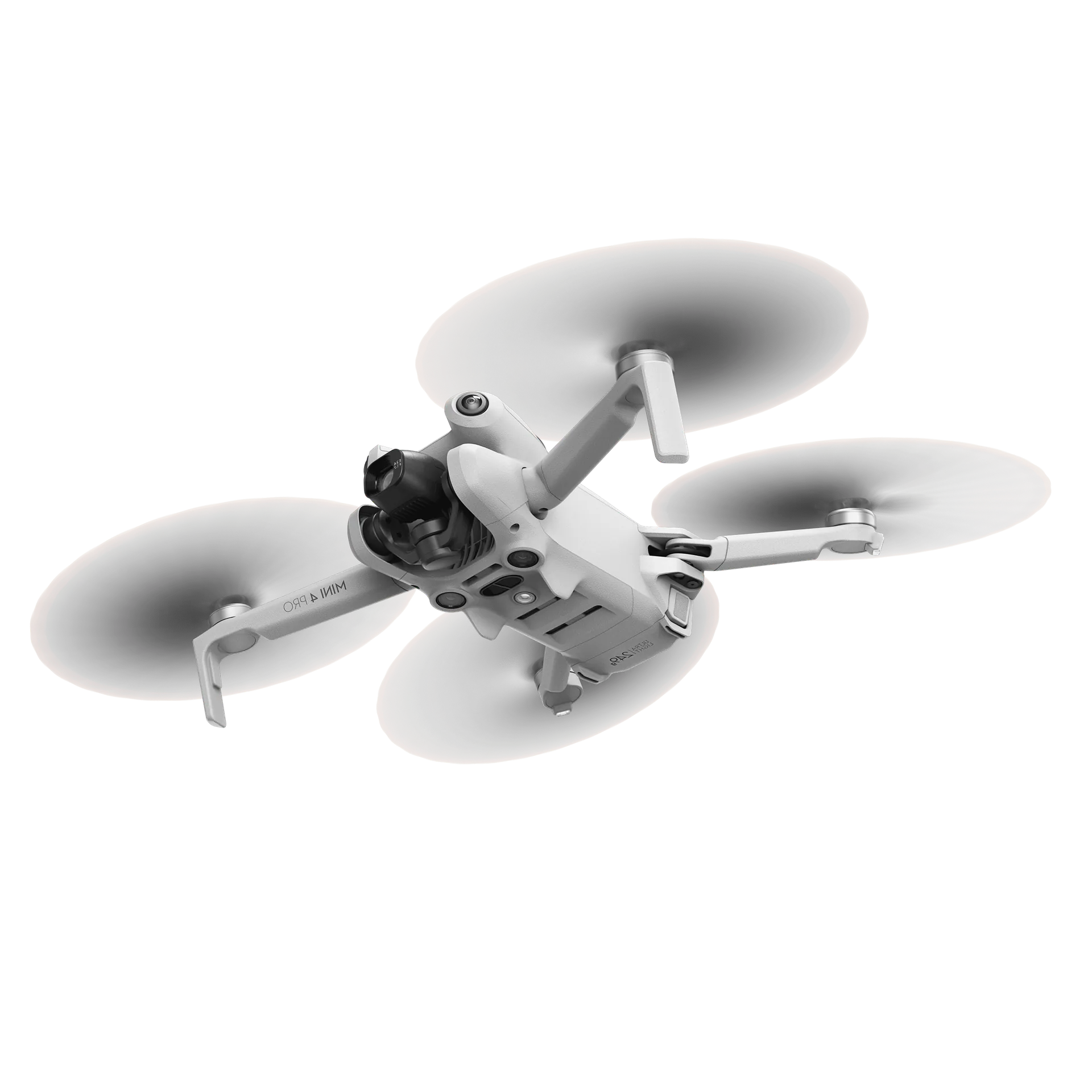
Stockpile management by drone: how it works and what it delivers
Most yards do not know exactly what is lying there. How a drone survey captures your stock to the centimetre, what it delivers, and when it pays for itself.
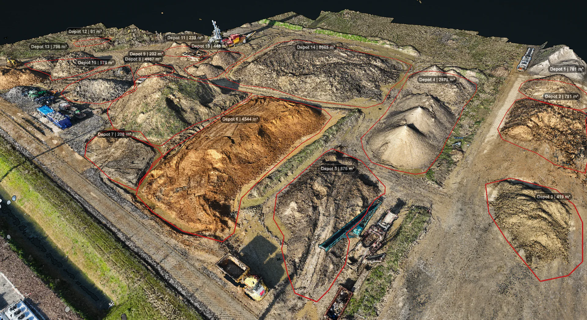
Ask anyone on a yard how much sand, gravel or crushed rubble is lying there and you will get an estimate. Often a good estimate, from someone with twenty years behind them. But it is still an estimate, and the gap between it and reality only shows up when something forces the question: the monthly figures, an argument with a customer, or the year-end close.
This article explains how a drone volume survey works, why it is more accurate than estimating, and what it delivers. Not technology for its own sake: the question is whether you know what is standing on your yard.
Why estimating goes wrong structurally
The problem is not that people estimate badly. The problem is that a pile of material cannot be estimated. A five-metre heap with an irregular foot and a worn-down flank holds a very different volume from the tidy cone you picture. By eye, bulk material typically lands 5 to 15% off the real figure, and every colleague is off in their own particular way.
The weighbridge does not solve it, and that is worth being clear about. A weighbridge measures loads in and out, so flows. It knows nothing about what is standing on your yard right now. As long as everything that comes in also crosses the bridge on its way out, the records hold. But the moment material is moved, screened or crushed internally, it bypasses every measurement you have.
- By eye: 5 to 15% off, and every colleague estimates differently
- The weighbridge: accurate per load, but blind to what stays behind
- Internal processing: moving, screening and crushing passes no measurement at all
The result is a structural uncertainty sitting on one of your largest assets. Invisible day to day, and very visible the moment someone asks about it.
How a drone volume survey works
The method is called photogrammetry, and the idea behind it is surprisingly simple. The drone flies a set pattern over the site and takes hundreds of photos that overlap generously. That means every point on the ground appears in dozens of photos, each time from a slightly different angle.
Software finds those same points across all those photos and works out, from how far they shift between images, where each point sits in space. It is the same principle your own eyes use to judge depth: two views from slightly different positions are enough to establish distance. The result is a point cloud of millions of 3D points that together describe the shape of your site.
One more thing is needed for a volume: a reference surface. The software establishes where the foot of the pile sits and calculates the volume between that surface and the material above it. That is exactly the same arithmetic a surveyor uses, only with millions of measurement points instead of a few dozen.
That is also where the higher accuracy comes from. Not because the technology is clever, but because the pile is captured in its full shape: the bulges, the worn flanks and the irregular foot that a tape measure or the naked eye never accounts for. A properly executed drone survey lands within 1 to 3%, against the 5 to 15% of an estimate.
Deeper into the technology: how accurate is a drone survey really?What such a survey gives you
Setting the technology aside, the practical output of a flight is always the same:
- The shape of every stockpile, captured in a 3D model of the whole site
- The volume per stockpile in cubic metres, measured from the real foot of the pile
- Imagery of the site exactly as it stood at that moment
- A dated survey you can repeat in precisely the same way later
That last point gets underrated and may well be the most important. One accurate survey tells you what is there now. Two surveys produced the same way tell you what happened in between. Only then does stock become something you can steer on rather than something you observe.
Estimate, weighbridge or drone
| Estimating | Weighbridge | Drone | |
|---|---|---|---|
| Accuracy | 5 to 15% off | Accurate per load | 1 to 3% off |
| Measures what is there | Approximately | No, flows only | Yes, the whole pile |
| Survey frequency | Ad hoc | Per load | As often as you like |
| Consistent between colleagues | No | Yes | Yes |
| Support for annual accounts | Open to challenge | Partly: mass, not volume | Dated and traceable |
What inaccuracy costs you
A 15% deviation stays abstract until you put a number on it. On 500,000 euro of stock, that is 75,000 euro in play per survey. Not money you have lost, but stock value you cannot vouch for: working capital you have no grip on.
Where it really bites is at the close. If the records differ from what is actually on the ground, the difference has to be corrected, and that correction lands on your result rather than your revenue. That makes it weigh more heavily than the figure itself suggests. In practice we see monthly stock swings of 25,000 to 30,000 euro per site at concrete producers, and at one recent year-end the difference came out above 100,000 euro.
Then there is the daily damage nobody invoices. Half-empty loads. Saying no to a customer while the material is in fact sitting there. An argument over quantities that nobody can settle. On one batch of aluminium there turned out to be 1,600 m³ where the customer expected 1,800 m³: at the aluminium price, a difference worth tens of thousands.
When does it deliver most
Not every yard gains equally. The return is largest at companies where one or more of these three things apply:
- Heavy internal processing: material is processed, screened or moved, and none of it crosses the weighbridge
- Fast-moving stock: high throughput and piles that appear and disappear, so survey errors accumulate until the year-end close
- High material value: with granulate, metal and secondary raw materials, every percent of survey error feeds straight through to the balance sheet
The more of these that apply, the wider the gap between what you think is there and what is actually there. If you hold a stable stock of one material that crosses the bridge cleanly, the gain is limited.
How often is surveying worthwhile?
That follows from what you use the figures for, and from how fast your stock moves. If you steer on monthly numbers you need a monthly survey; for supporting the annual accounts a quarterly one gets you a long way.
How often should you survey your stock? The full pictureWhat a volume survey does not do
A drone measures volume, not weight. To go from cubic metres to tonnes you still need a density figure, and that varies by material and by moisture content. For most stock records that is no obstacle, but the survey does not take that step off your hands.
Beyond that, the camera needs a line of sight. Material in a shed or under a canopy cannot be surveyed from the air, water surfaces yield no reliable points, and dense vegetation hides the ground beneath it. On an open yard with bulk material those limits rarely come into play, but it is worth knowing where the boundary sits.
What to watch for when you start
The technology is mature by now. Whether a volume survey delivers in practice what it promises depends mostly on how you organise it. Four questions make the difference:
- Who carries out the survey? Surveying yourself or hiring it in decides how quickly you have a figure and how often you can repeat it
- Is the method reproducible? Only if every survey is produced the same way can this quarter and last quarter be compared
- Can you explain it to your accountant? For stock valuation a survey has to be dated, documented and traceable
- How much expertise does it ask of your own people? Photogrammetry is a discipline, and the question is whether you want that discipline in house
That last question is the deciding one for many companies. Standalone drones and standalone 3D software are on the market, but buying them means buying the work that comes with them: flight planning, processing, quality control and reporting.
How we do it
AiroMap is our answer to exactly those four questions. It is one package with drone, software, training and support, built to put the survey in the hands of your own people without anyone having to learn photogrammetry. The drone plans and flies the route itself, processing happens in the cloud, and the volume calculation and report come out automatically.
In practice: you put the drone down on the yard, mark the area you want surveyed, and start. Reckon on about ten minutes per stockpile, and on the first volumes roughly half an hour after landing. Your own people are operational after half a day of training, with no prior knowledge or drone experience, and from then on they survey when it suits them rather than when somebody else is available. One fixed subscription, unlimited users, so an extra survey does not cost you a new order.
Reviewed for the annual accounts
The survey process has been reviewed and validated by a large independent accountancy firm as a basis for stock valuation in the annual accounts. Every survey is dated, documented and reproducible, which makes it defensible to your auditor.
An example of how that plays out: AVG, one of the larger recycling and raw-materials companies in its region, has surveyed its full stock across all six sites every quarter since 2025. Because every survey is produced the same way, the figures per site are comparable over time. "A real step towards stock management we can rely on", is how they put it themselves.
Read the full AVG storySee how stock surveys work with AiroMap